How to Hike Burstall Pass in Kananaskis Country

Burstall Pass is a classic hike in Kananaskis Country that is popular year-round. It’s fantastic in the summer thanks to its wildflowers, great in the fall thanks to the larches, and even offers fantastic snowshoeing and backcountry skiing in the winter.
The trailhead is right off the Smith Dorrien Road past Mount Engadine Lodge, and while it starts off a bit boring, it certainly doesn’t end that way. The hike moves past several marshy lakes and streams before a steep ascent up to an alpine meadow and then finishes on a high mountain pass with grand glaciated mountain views.
We’ve now hiked this trail many times and it’s become a favorite of ours. During the summer, we love hiking through Burstall Pass and can spend most of our time alone in the woods, especially on weekdays. In the winter, Burstall Pass is a popular place to ski tour and snowshoe. It’s a long one at 16km and a little redundant since it’s an out-and-back trail, but the views more than make up for it.
All About Hiking Burstall Pass
Key Points

Length
16.4 km

Duration
4 – 7 hours

Elevation
675 m

Difficulty
Moderate

Trailhead
Mud Lake
Burstall Pass Route Description
Burstall Trail starts from Smith Dorrien Trail, with a large parking lot serving the trail and stunning Mud Lake. The trailhead is right across the road from the Chester Lake Trailhead. The hike starts along Mud Lake before following an old road for 4 kilometers that bicycles can use. It then continues for almost 2 more km before reaching a series of streams and creeks.
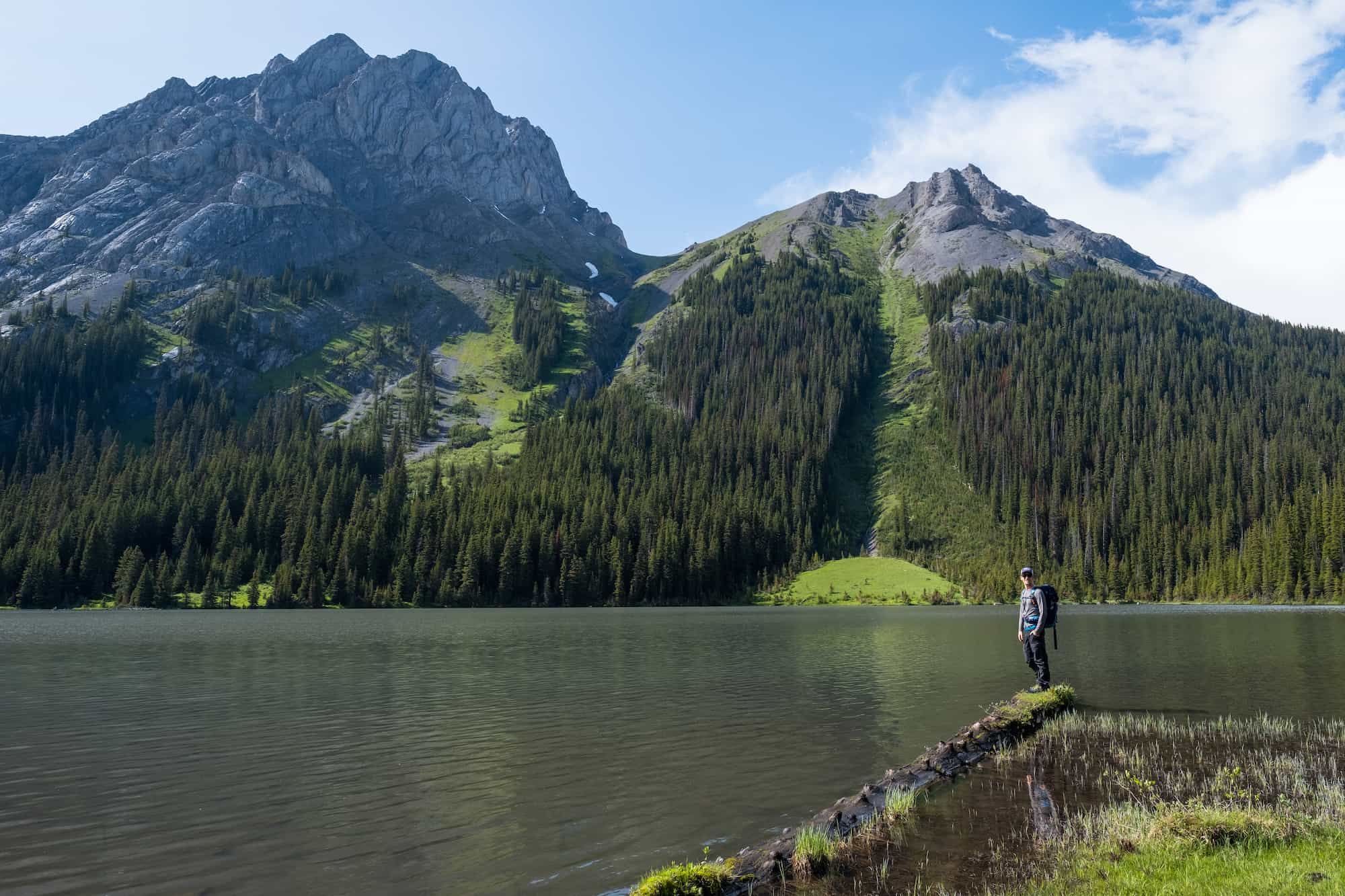
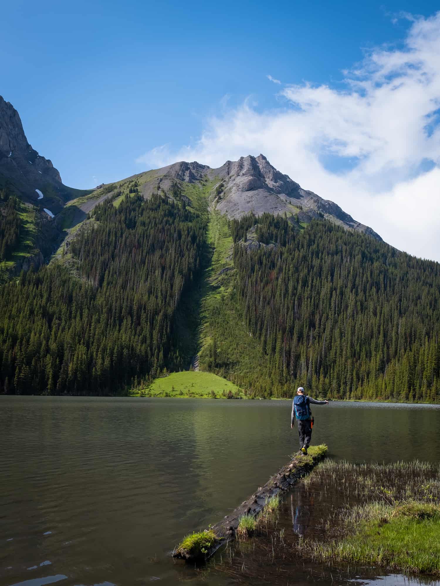
As you move along the dirt road, keep an eye out for the trails down to the three Burstall Lakes. All of them are breathtaking and offer some of the best views on the hike until reaching the top of the pass at the end.
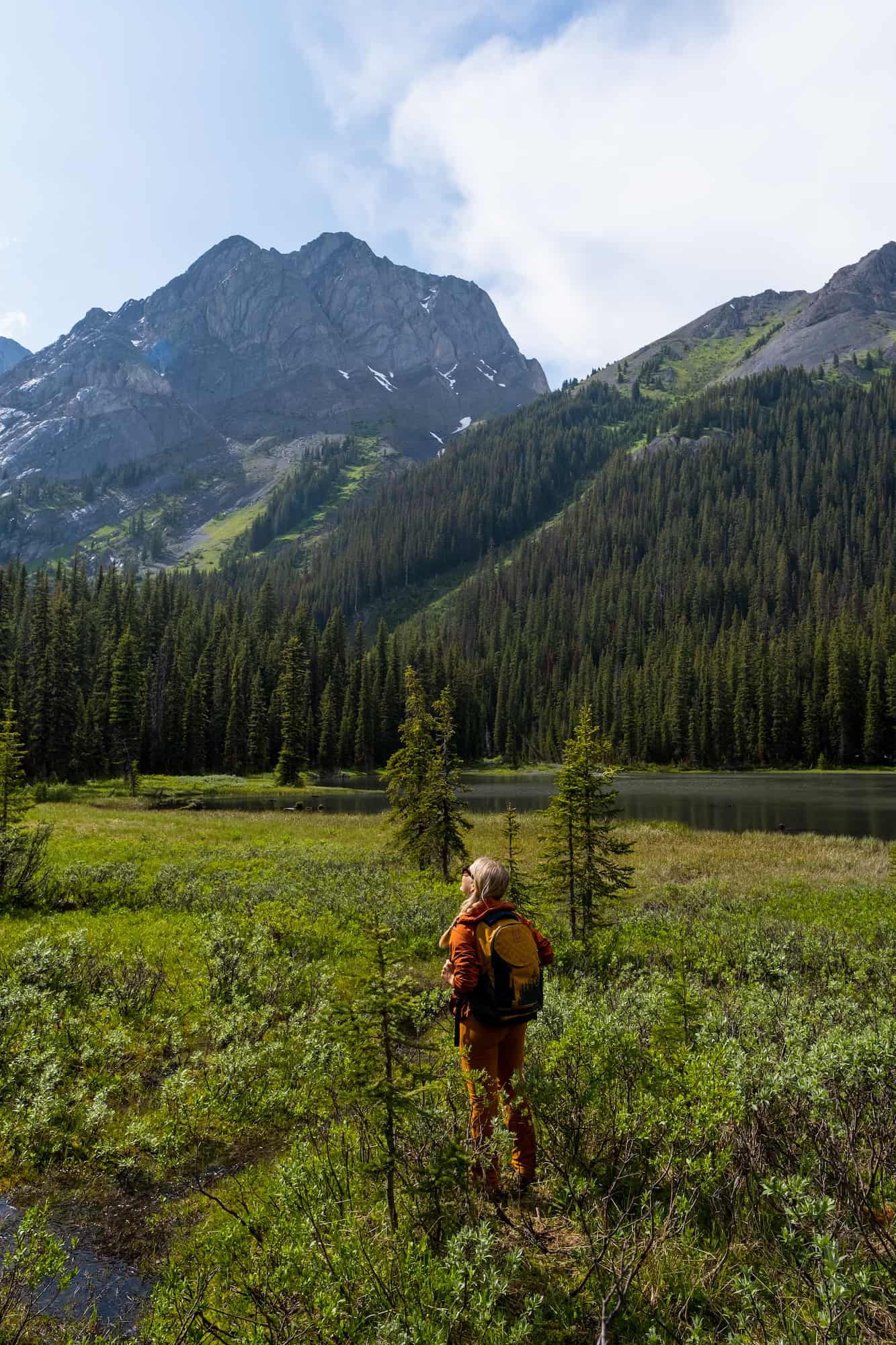
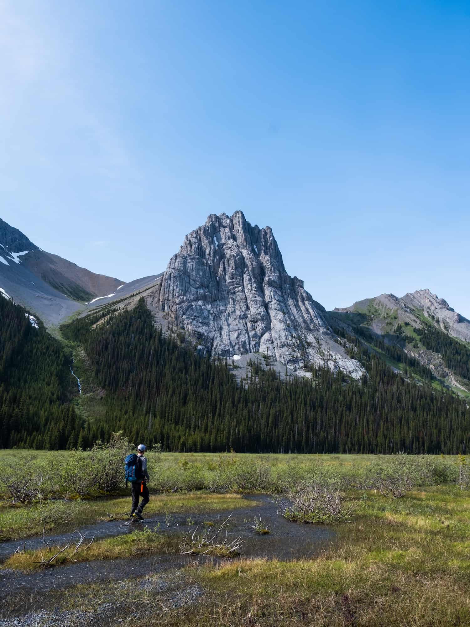
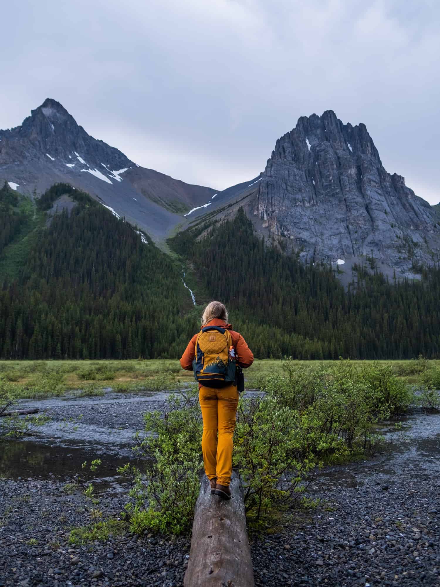
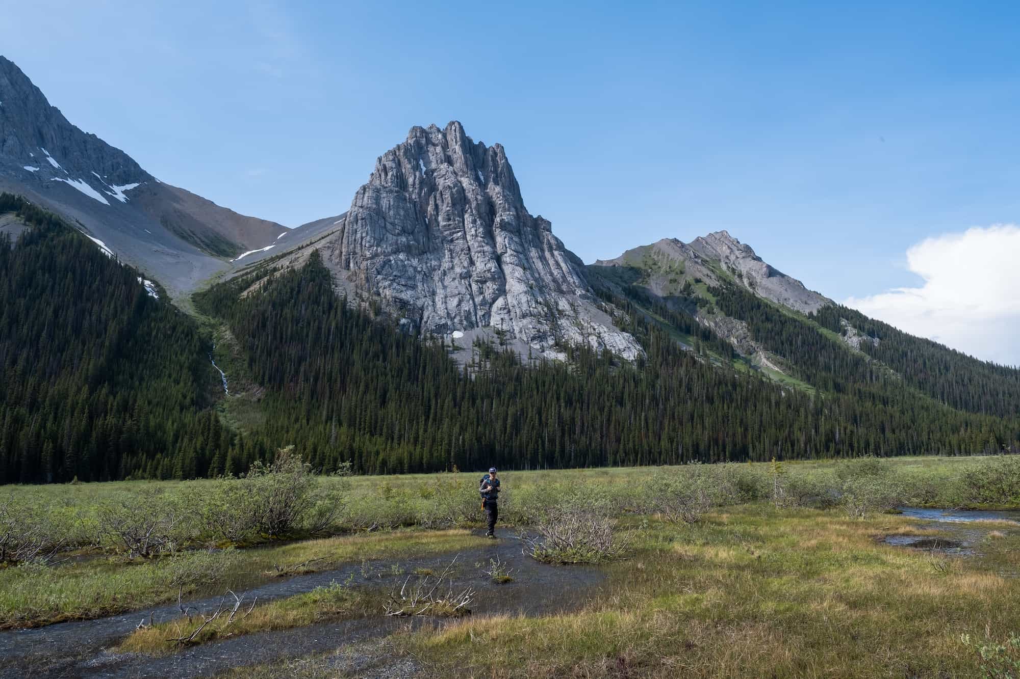
From there, the trail continues along through the forest and valley. It’s a prime spot for birders, and we stopped multiple times to listen to their calls. When you reach the end of the first forest section, you come to the alluvial fan of the Robertson Glacier, where you also get great views of Commonwealth Peak.
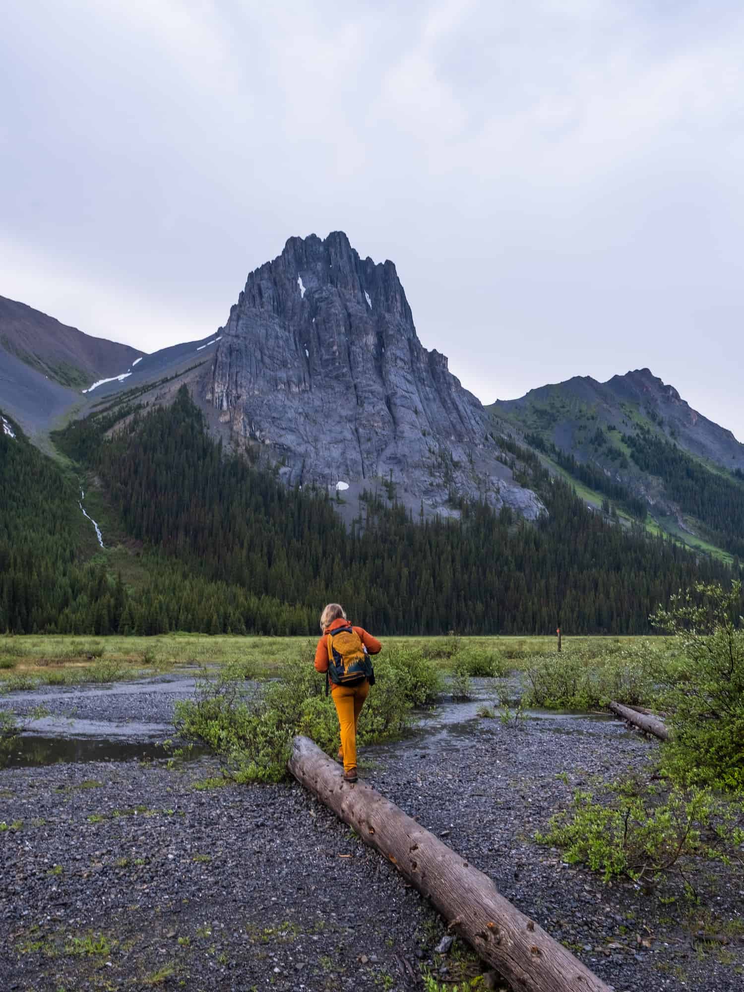
Come prepared for some smart route-finding and waterproof shoes, or perhaps some hiking sandals during the summer. The fan spreads across the trail with multiple streams and flooded sections to cross. It is not difficult, but it takes some time to make it across the streams about 500m long without getting wet feet.
Some helpful signs mark the trail for hikers to follow across the plain. However, we used them as a reference to find the ideal route to remain dry. Lots of hopping was done.

After you make your way across the flooded sections of trails, you reach more forest. Keep your eyes open for the trail up, as it can be tough to spot. This is where the trail begins to ascend to an alpine meadow. It’s a pretty steep climb but easy enough for most people to handle without too much of a struggle. It’s also over relatively quickly. From there, you’ll reach a sub-alpine meadow filled with wildflowers/or larches that takes around a half-hour to walk through.


The meadow continues for a while until another uphill climb finally reaches the highest point of the pass. Along the way, it’s hard not to be blown away by the views of Mount Birdwood. The top of the pass sits at 2,380 meters and then drops down before entering Banff National Park and Palliser Pass. You’ll see a sign at the park border, and there’s a well-maintained trail if you want to keep going and have a map or idea of your destination.


From the top of the pass, you have some commanding views of the peaks in the area. Some famous peaks include Mt. Birdwood, Assiniboine, and Mount Sir Douglas. Mount Assiniboine is easily one of the more popular mountains known for its perfectly shaped peak and is the sixth-highest mountain in the Canadian Rockies.

We wish we had more time at the summit to explore, and possibly summit the nearby Snow Peak. However, we were caught in a tremendous thunderstorm and decided to head back before we started shivering.
(Update) We’ve now enjoyed this trail a few times and were able to continue along the pass into Banff National Park, following a trail that led us to a fantastic viewpoint over Leman Lake. I’d love to return and plan a longer backcountry outing in this area, as it’s one of the most stunning areas of the park.


Snow Peak
I would have loved to summit Snow Peak, as it looked like an easy scramble. However, the thunderstorm that rolled in just as we made the pass was one of the most threatening we’ve seen while hiking in the Rockies. Heavy rain mixed with light hail, high winds, and lightning—not fun!
We had to get off the pass and into the trees as fast as we could. We’ll have to save it for a later point and time. This would be a great option if you want to add an additional objective to the hike.
Hiking Gear We Recommend

It’s tough to beat the comfort and stability of the Speedgoat. A more technical shoe would be the Salomon X Ultra.

It’s always jacket season in the Rockies. We always carry a down jacket on every adventure.

This nifty clip from Peak Design secures a camera to my backpack strap for easy reach. No more digging in the backpack!


A lightweight backpack is perfect for most hikes in the Rockies. We suggest keeping it simple and carrying the basics.

In case of emergencies, we carry a GPS-enabled emergency beacon. Solid for regular backcountry users.
Burstall Trail Duration

The trail takes us 4-5 hours to hike, but we keep a pretty good pace. It’s 16km long and climbs more than 500 meters, with most of the climb towards the end of the hike. Though it’s truly the long road that feels like it eats up a majority of time. Next time, we’re bringing a bike to at least get the 4km out of the way quickly in and out. (Update – did that on our last hike and highly recommend the bike plan if you have one!)

There are two steep sections in the forest before you arrive in an Alpine area with sweeping views. Save yourself four to seven hours to complete this hike or more if you plan to climb any of the nearby peaks or head into Banff National Park from the top of the pass.
How Hard is Burstall Pass?

AllTrails rates this as a moderate trail and we’d have to agree. There is not too much elevation gain and nothing technical with exposure. It requires a bit more stamina than most moderate trails, as it is 16km long – depending on where you turn around.
When Can You Hike Burstall Pass?
As the trail lies low in elevation and has easy slopes, it’s good to hike early and late in the season. Anywhere from April to October is likely a good time to hike Burstall Pass. It’s a great wildflower hike in July and August, and September is tremendous as there are a lot of larches in the area.


Burstall Pass is also a very popular ski tour and snowshoe area during the winter months, as it is an easy ski tour with low avalanche risk.
How Popular is the Burstall Pass Hike?
Burstall Pass is moderately trafficked. Each time we hike it, we are after a quiet trail, so we usually arrive later in the evening, knowing we can complete the trail fast. We only passed several groups along the way. On a nice weekend, it’s pretty popular trail in Kananaskis as it’s very accessible. Burstall Pass is perfect for a walk with the family, dogs, trail running, etc.
What About Dogs and Kids in Burstall Pass?
The beginning of the trail is appropriate for anyone who can walk along a flat surface. Towards the end, it would still be appropriate for anyone of moderate fitness.
I’d say from eight years old and up, maybe even younger, depending on the hikes under their belt. Big dogs should be able to handle the trail just fine. Just keep in mind it’s 15km in length, so they’ll need to be able to walk for that long.
Want Another Great Hike in Kananaskis?

If you enjoyed Burstall Pass and are looking for another popular hike, only a few kilometers away is Tent Ridge. It’s a hike that is more technical, with a small scramble and mild exposure. The views from Tent Ridge are some of the best in Kananaskis Country. It’s truly one of the best in Kananasis, along with Smutwood Peak – also nearby!
Wildlife Awareness In Burstall Pass
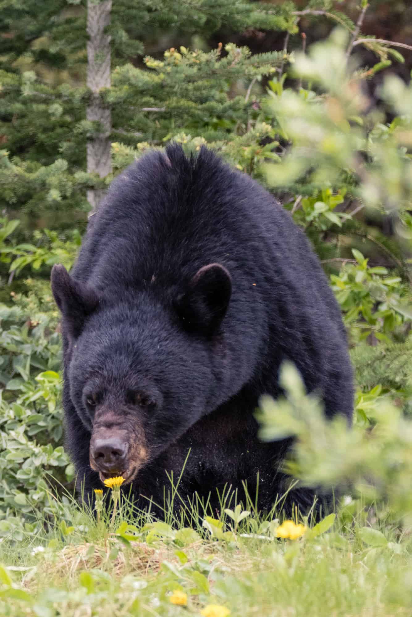
If you’re on any hikes in the area, you should practice good wildlife awareness. There are frequent sightings of black bears, grizzly bears, moose, elk, and cougars in the region. They all present a threat to humans, and we should reduce our impact on their natural lives. Last time we hiked Burstall Pass, we saw a moose and a grizzly on the trail.
Before any hike in Banff National Park or Kananaskis Country, you should pack bear spray, check the park websites for wildlife information (Parks Canada and AB Parks), and then check again for notices at the trailhead.
When you’re on the trail, make noise by banging hiking poles, talking, whistling, clapping, or singing. This is particularly important around blind bends and corners, although there aren’t many in Burstall Pass. It’s also a busy trail, so you generally don’t need to make too much noise, but always be bear aware.
This means staying alert, traveling in a group, minding children and pets, and finally, carrying bear spray and knowing how to use it. If you’ve come to the park without bear spray, Valhalla Pure Outfitters in town sells spray and holders with employees who will demonstrate how to use them properly.
A Pass is Needed to Hike in Kananaskis
Visitors are required to hold a Kananaskis Conservation Pass, which covers Kananaskis and the Bow Valley Corridor. This pass is separate from the National Parks Pass needed to visit Banff and the other national parks. Passes may be purchased online and are attached to a license plate number. Requirements are around vehicles and parking, not the individual. This includes parking at the Canmore Nordic Center or Grassi Lakes.
Pass Prices
- Daily Pass: $15 (registers one vehicle)
- Annual Pass: $90 (registers two cars)
A Guide to Understanding the Kananaskis Conservation Pass
What to Wear On a Hike?

The most basic principle of what to wear hiking is layering. Anyone who has spent time in the wilderness or mountains can speak to the fact that your temperature can fluctuate a lot on a hike. You can easily start off cool at the mountain base and get hot as soon as you begin moving.

If you’re heading to Western Canada soon make sure to check out our interactive map with over 450 spots to help you plan!
- ✅ Hiking trails with links to trails & insider tips you won’t find online
- ✅ Our favorite photo spots, scenic views, waterfalls, must-visit attractions, and even swimming holes
- ✅ Our favorite restaurants, coffee shop & local spots that many skip.
- ✅ We add as we explore ourselves. That means we add new points every month!
- ✅ Map works with Google Maps!
- ✅ Pre built itineraries you can replicate,
- ✅ Discover spots via an ad-free interactive map and a grid, full of original content and videos
- ✅ Use on the go, mobile-first, offline-friendly, and made for the road.
- ✅ Local insights you won’t find on Google or AI – all in one place!


