30 EASY Hikes In Banff For The Whole Family

Many visitors are not up for death-defying mountain summits in the Canadian Rockies. However, everyone should go for at least one hike while visiting, regardless of age, experience, or ability. If this is you, there are plenty of family-friendly, easy hikes in Banff to enjoy. Trust me when I say, there is no better way to take in the fresh mountain air and gorgeous vistas the park offers than from the hiking trail.
Heading to Banff and not enjoying a few easy Banff hikes or walks in the wilderness would be a disservice to you. These easy hikes in Banff and a few from the area are appropriate for everyone and will supply outstanding natural sights and pristine wilderness. These easy hikes occur on maintained trails and will surely be enjoyed regardless of your skill or fitness level.
The Best Easy Hikes in Banff
Fenland Trail


- Length: 1.8 km
- Duration: > 1-Hour
- Elevation Gain: Minimal
- Best Time To Go: Year-Round
- Trailhead: Banff or Fenlands Recreation Center
Fenland is an easy loop through the forest just outside of town. It’s also a great way to connect the town with a walk to the docks of Vermilion Lakes for a beautiful morning or evening hike. The trail is scenic and loops through the forest along Echo Creek, a tributary that connects Vermilion Lakes and the Bow River.
It’s a relaxing walk that offers some pleasant river views and a few mountain views of Mount Norquay. If you’d like to spot some wildlife, this is an excellent trail, as lots of birds nest in the marshlands of Vermilion Lakes, and elk often rut along Echo Creek. It’s not much of a hike, but it’s a great way to stretch your legs and enjoy nature.
Stewart Canyon

- Length: 6.8 km
- Duration: 2 Hours
- Elevation Gain: 260 meters
- Best Time To Go: Year-Round
- Trailhead: Lake Minnewanka Parking (GPS)
- Public Transport: Roam Route 6
The Stewart Canyon hike is a great option if you plan to spend your day exploring the loop drive just outside of Banff. It’s a short 6km hike to and down Stewart Canyon. Most of the trail follows along Lake Minnewanka for some pleasant lake views. Eventually, the trail reaches a wood bridge over Stewart Canyon and the Cascade River for an epic view. The course is well-graded and remains relatively flat for most of the hike, so most should be capable.
It’s a great area to spot some wildlife, but carry bear spray and check for trail closures. The good news is that this trail can be completed year-round. You may have to contend with snow or ice in winter and early spring. You can hike further along the canyon or the trail that follows the Lake Minnewanka shoreline, which continues for 30km. It’s best to turn around whenever you feel ready, but we encourage everyone to hike to the wooden bridge.
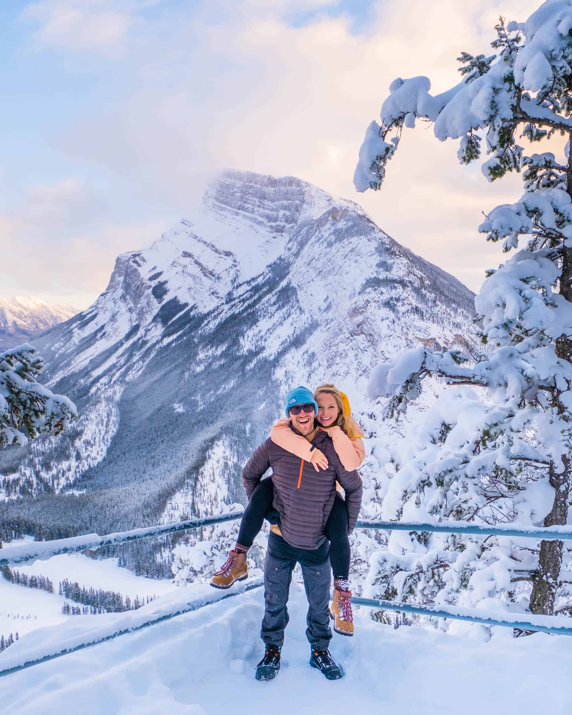
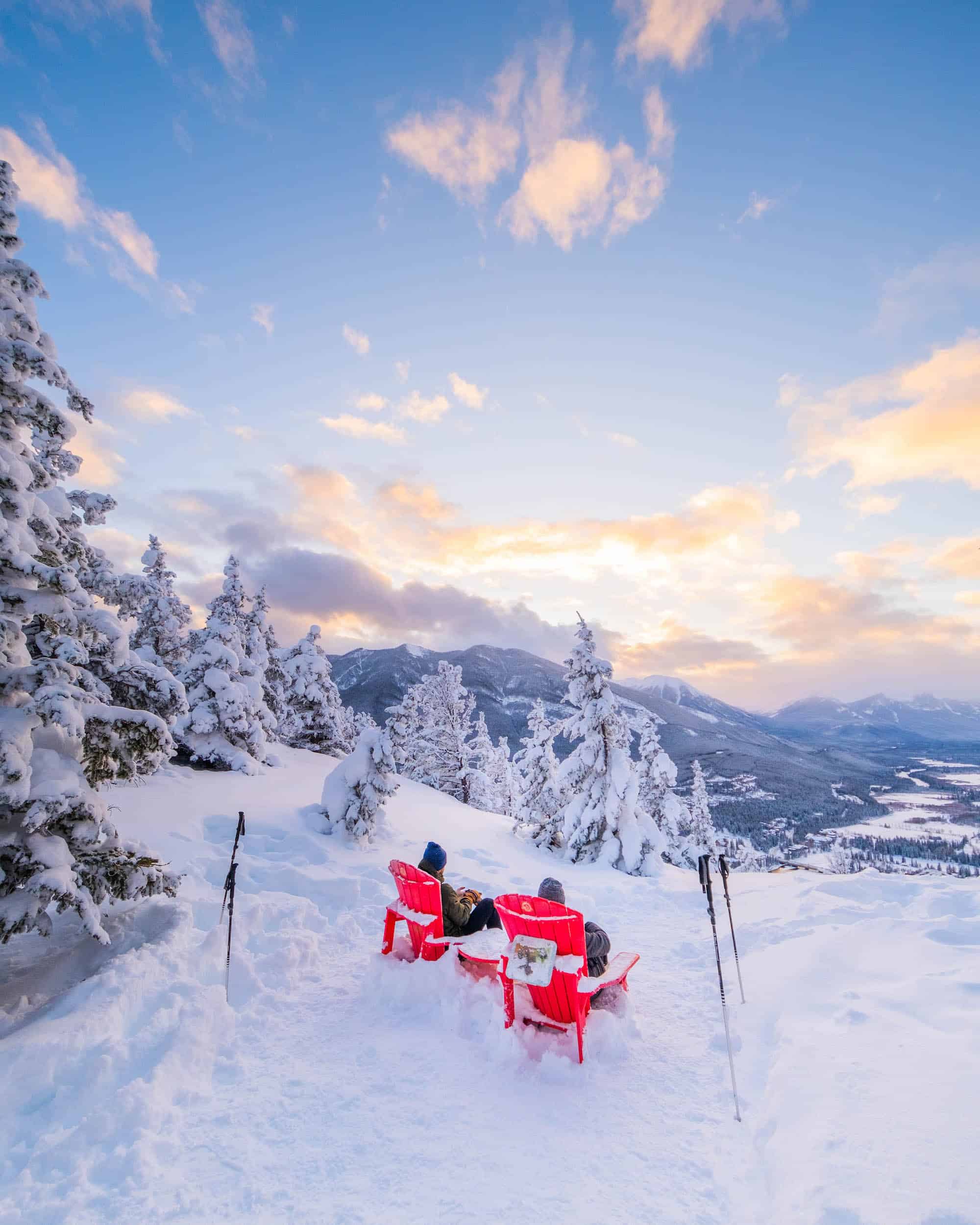
Sulphur Mountain / Cosmic Ray Station

- Length: 1 km
- Duration: 1 Hour
- Elevation Gain: 35 meters
- Best Time To Go: Year-Round
- Trailhead: Banff Gondola
- Public Transport: Roam Route 1
Hike along a mountain top without climbing to the top, thanks to the Banff Gondola. From the gondola’s top station is a delightful hike along elevated boardwalks to the Cosmic Ray Station. The station was built in the late 50s as part of an international cosmic weather study, and the structure still stands with its outstanding views.
The boardwalk is flat and only has a few flights of steps. Since you do not need to watch every step, you can spend more time looking out at the sweeping views of the mountains all around. There are also several scenic viewpoints along with an interactive discovery center, gift shop, cafe, and restaurants in the Banff Gondola Summit Center. We recommend that anyone who takes the Banff Gondola take a walk along the boardwalk.
You can hike up Sulphur Mountain to the top from the Banff Gondola base for a more challenging and free version. It’s an easy trail, but you do have a fair amount of elevation gain, so some fitness level is required. We consider the hike up Sulphur Mountain to be a more moderate hike in Banff. It’s a great hike and can be done in the winter, plus it’s easy to reach with public transport.
Panther Falls

- Length: 1.3 km
- Duration: Under 1 Hour
- Elevation Gain: 75 meters
- Best Time To Go: Year-Round
- Trailhead: Panther Falls Parking (GPS)
This is a super short 1 km hike along the Icefields Parkway and a great way to stretch your legs. It’s not immediately visible from the highway and remains a little hidden. As a result, it sees a fraction of the visitors of other popular waterfalls along the parkway, such as Sunwapta and Athabasca.
Those who do make the stop are rewarded with a stunning waterfall that can be viewed from behind the falls. The natural surroundings are astounding and a great spot to soak up nature. It may be even better in the winter as the waterfall freezes and forms huge icicles. If you plan to visit in the winter, having some microspikes and a helmet is good if you want to walk underneath. In the summer, you’ll want decent hiking shoes as the trail is not well maintained.
Two Jack Lakeside

- Length: 4.7 – 7.3 km
- Duration: 1-2 Hours
- Elevation Gain: Minimal
- Best Time To Go: Spring-Fall
- Trailhead: Two Jack Lake Parking (GPS)
Two Jack Lake is one of our favorite lakes in Banff, so naturally, a hike along its shoreline is great. It’s a breathtaking lake and often casts a reflection of the iconic Mount Rundle. The hike follows a trail that connects Two Jack Lake with the neighboring campground and the Cascade Canal.
The hike is not busy, but the lake and water are popular on a lovely sunny day. Two Jack is a playground for water sports and a fabulous picnic spot. You won’t be alone, but the hike is often quiet. Start from the car park and follow the shoreline trail towards Mount Rundle to follow the trail.
The trail follows the lakeshore until it reaches the Cascade Canal, and a bridge leads over the canal just past the campground. That makes a good turnaround, or you can cross the bridge and follow the canal to Johnson Lake Road. The only issue is that you can’t loop the trail and need to walk back towards the car park.
Cascade Falls

- Length: 1.3 km
- Duration: 1 Hour
- Elevation Gain: 144 Meters
- Best Time To Go: Summer
- Trailhead: Banff Airfield Parking (GPS)
Every visitor to Banff will see Cascade Mountain looming over the Bow Valley. It’s a huge mountain, and the Cascade Falls are tough to miss as they tumble down the mountain. Not far from the overpass of the TransCanada lies a small parking lot where you can cut through the trees and towards the waterfall.
It’s a short and steep climb up scree to reach the fall, but it shouldn’t take more than 20 minutes. As a reward, you’ll get to touch the water and catch some views of the Bow Valley down below. This hike can be a little more difficult, although we’d still classify it as an easy hike because it’s so short. The scree can be challenging to climb, so be sure-footed.
Bow Falls Viewpoint

- Length: 3 km
- Duration: 1 Hour
- Elevation Gain: 50 Meters
- Best Time To Go: Year-Round
- Trailhead: Town Of Banff
The Bow Falls viewpoint is one of our favorite walks in Banff. Whenever we feel like a change of pace, we’ll grab a coffee and walk from town to Bow Falls along the Bow Falls trail. The viewpoint at Bow Falls is about 1.5 km from the center of downtown Banff, and along the way, you’ll cross over the Bow River to get some astounding views of the Bow Valley from the bridge.
After the bridge, the trail to the falls is paved or gravel and very easy outside one steep stair section that provides a view over the falls. However, the classic viewpoint lies a little further and just below the famous Banff Springs Hotel. If it’s a nice summer day, consider heading up to the hotel’s restaurant, Waldhaus, for beautiful views and German beer.
Athabasca Toe Glacier

- Length: 1.4 km
- Duration: 1 Hour
- Elevation Gain: 61 Meters
- Best Time To Go: Summer
- Trailhead: Toe of the Athabasca Glacier Trailhead (GPS)
While Banff’s lakes will take your breath away, the Columbia Icefield is humbling. The Athabasca Glacier sits right along the parkway at the Banff/Jasper border and beckons for exploration. While not everyone is a mountaineer, the glacier offers everyone an opportunity to experience it.
You can still hike to the glacier’s toe if you don’t feel like shelling out over a hundred dollars to hop aboard an “Ice Explorer” vehicle. It’s a short hike to the toe of the glacier from a car park across the street from the Discovery Center.
Due to the elevation, loose rock, and steep trail, it may be difficult for some. Despite a few difficulties, the hike is short enough to be completed by almost anyone. Have a warm jacket as the katabatic winds from the glacier feel like standing in front of an open freezer.
The main viewpoint is roped off for your safety. It is possible to reach the glacier, as shown in the photo above, but it involves crossing several moraines, navigating around rushing streams, and then trekking onto the glacier. It is a much more daunting and dangerous experience than one would believe. Please take caution if you decide to go past the barriers; it’s really best to do it with a guide (recommended below).
If you want to REALLY enjoy the glacier, we recommend booking this half day Icewalks tour!
Boom Lake

- Length: 10.2 km
- Duration: 3-4 Hours
- Elevation Gain: 175 Meters
- Best Time To Go: Summer-Fall
- Trailhead: Boom Lake Day Use Area (GPS)
Boom Lake is a gorgeous alpine lake near the border of Kootenay National Park that can only be reached on foot. The majority of the trail is flat and very approachable for beginner hikers. It’s a nice hike through the forest, and you’ll see some of the largest trees in the park. The start of the hike is the most difficult, as you gain around 100 meters, but after that, it’s smooth sailing.
Compared to many of Banff’s more popular hikes and sites, the hike to Boom Lake allows you to be alone in nature. The real draw is the crystal clear Boom Lake, which, with substantial mountain views, makes this easy hike a winner. The trailhead lies off 93S, just before the border of B.C. and Kootenay National Park.
Johnston Canyon

- Length: 5.1 km
- Duration: 2 Hours
- Elevation Gain: 120 Meters
- Best Time To Go: Year-Round
- Trailhead: Johnston Canyon Parking Lot (GPS)
- Public Transport: Roam Route 9
We love the hike in the winter due to the summer crowds, but there is good reason to visit in the summer. A summer hike is visceral as the roaring water reverberates through the canyon and into your chest. As a hiker, you get up close and personal with the canyon, thanks to a series of suspended walkways. Hikers catch scenic glimpses of the mountains, multiple waterfalls, and a chance to spot wildlife along the way.
In the winter, the waterfalls are locked away in a massive swath of ice. If you’ve never seen a frozen waterfall, this is a beautiful opportunity to do so. The trail along Johnston Canyon is open year-round unless Parks Canada notes otherwise.

If you plan to hike in the winter or early spring, we suggest renting or buying ice cleats in town. Although the trail is well managed, it can get icy, and it’s better not to slip everywhere on the path—ours were very handy! No matter the season, it’s an easy hike along a well-maintained trail suitable for all ages. For an extended hike, continue on to the Ink Pots.
If you plan to hike in the summer, just be forewarned the trail is very busy between 9 and 6pm, so it’s best to go outside those hours.
Hector Lake

- Length: 4.5 km
- Duration: 1 Hour
- Elevation Gain: 65 Meters
- Best Time To Go: Summer
- Trailhead: Hector Lake Pull Off of the Icefields Parkway (GPS)
Hector Lake is a glacier lake in Banff that only a few hikers visit. It’s also staggeringly beautiful, but it does come with a catch. It requires a short muddy hike to reach. This deters most visitors, but the hike is straightforward and quick at just under 5 km round trip.
The hike down to the river is just over two kilometers and takes around half an hour. The trail can also be a little muddy, but the small detractions are easily outweighed by the serenity of sitting along a gorgeous glacial lake in solitude. There is an option to cross the Bow River to get to a different section of the lakeshore, but this can easily be avoided by taking the trail to your left to Hector Lake. If you decide to cross the river, keep an eye on the water levels, as they can rise late on a hot day due to snowmelt, which can become dangerous if you’re not prepared.
Chephren Lake

- Length: 7 km
- Duration: 2 Hours
- Elevation Gain: 80 Meters
- Best Time To Go: Summer
- Trailhead: Waterfowl Lakes Campground (GPS)
Chephren Lake is a gorgeous lake with staggering views of Mount Chephren above. What’s fantastic is that it’s a shimmering aquamarine lake with only a few visitors each day. You won’t be alone, but it’s a far cry from the crowds of the more popular lakes in the park. It’s an easy and mellow objective the whole family can do, but bring good shoes; the trail can be extremely muddy!
The hike up to the lake requires you to cover around 7.7 km and gain 80 meters of elevation. This would make it one of the more difficult Banff hikes on this list but still plenty doable for everyone. We recommend allocating sufficient time to fully enjoy Chephren Lake. If you’re super brave, throw on a swimsuit and jump into the lake — it’s very cold.
Sundance Canyon Trail

- Length: 7.4 km (9km if you do the loop)
- Duration: 2-3 Hours
- Elevation Gain: 155 Meters
- Best Time To Go: Year-Round
- Trailhead: Cave & Basin National Historic Site (GPS)
The Sundance Canyon trail is a great trail that starts at the Cave and Basin National Historic Site. It’s a fairly popular trail as it’s readily accessible and follows along the Bow River for a couple of kilometers. There are some great views of the river and the surrounding mountains along the way.
It’s a bit of a journey and some elevation gain to reach Sundance Canyon. However, for an easy version of the hike, we suggest turning around before you begin to gain elevation. If you’d like to extend, consider walking along the Healy Creek Trail, which continues along the Bow River. Much of this trail is paved, so it’s possible to make this trail quicker and easier by biking to the canyon.
Boundary Lake

- Length: 2.9 km
- Duration: 1 Hour
- Elevation Gain: 121 Meters
- Best Time To Go: Summer
- Trailhead: Banff/Jasper Park Boundary Parking (GPS)
We consider it a mini version of Lake Louise without any of the crowds. You may even be the only hiker if you make this stop! Boundary Lake is a bit of a secret before one of the busiest spots in Banff, the Icefields Discovery Center.
It can be a little difficult to find the trailhead of this gem, but it is well worth the effort. The parking lot is small and sits right along the boundary between Banff and Jasper National Park. You descend a short distance down the valley from the trailhead before climbing back up to the lake.
Lake Agnes

- Length: 7.6 km
- Duration: 2-4 Hours
- Elevation Gain: 495 metres
- Best Time To Go: Summer-Fall
- Trailhead: Lake Louise
The hike up to the Lake Agnes Teahouse is a classic in the Lake Louise area. It is considered an easy-to-moderate hike above Lake Louise (depending on fitness level), suitable for everyone as long as you don’t mind a bit of elevation gain. At the top of the climb, you’ll find the historic teahouse, beautifully situated on a high alpine lake.
This easy hike can be done in under two hours up and is one of those short hikes in Banff you can’t miss. However, be warned: it is a busy one and one of the harder hikes on this list (though considered easy by Canadian Rockies standards)! To escape the crowds (and get better views), keep climbing to the Little or Big Beehive. However, those hikes are more moderate to difficult.
Vista Lake

- Length: 2.8 km
- Duration: 1 Hour
- Elevation Gain: 126 Meters
- Best Time To Go: Summer-Fall
- Trailhead: Vista Lake Day Use Area (GPS)
Vista Lake is right off Highway 93 before crossing into Kootenay National Park and is one of our favorite easy hikes in Banff. It is an excellent, family-friendly lake since you can easily park and walk just over 100 meters down to the lake. If you don’t feel like hiking, you can also get a great view of the lake from the parking lot.
A small parking area for Vista Lake on the left-hand side of the road when driving from Banff to Radium Hot Springs. Keep an eye out for it once you pass Storm Mountain Lodge. Once you park, you only have to get out of the car for an incredible viewpoint of Vista Lake. The short 1km hike down to the lake will likely take less than 30 minutes. It is not stroller-friendly. If you want a longer and more challenging hike, continue to Arnica Lake, one of the best larch hikes!
Tunnel Mountain

- Length: 4.8 km
- Duration: 1-2 Hours
- Elevation Gain: 266 Meters
- Best Time To Go: Year-Round
- Trailhead: Tunnel Mountain
Tunnel Mountain is one of our favorite easy hikes in Banff because it’s right in the heart of Banff. It’s beloved by locals for its accessibility, and you can hike it year-round. It may be one of the smallest mountains in the park, but it still offers tremendous views of the surrounding valleys.
The hike slowly winds up the mountain through several switchbacks and offers various viewpoints of the Bow and Spray Valleys. The grand finale is the view over Mount Rundle in one direction and to the town of Banff in the other direction. It’s great for sunrise or sunset, and it rarely disappoints.
Stoney Lookout

- Length: 4 km
- Duration: 1-2 Hours
- Elevation Gain: 266 Meters
- Best Time To Go: Year-Round
- Trailhead: Mount Norquay
The Stoney Lookout Trail is a short but sweet hike that leads to a viewpoint overlooking the town of Banff, and you also get an up close view of Cascade Mountain in front of you. The hike begins at the Mount Norquay parking lot and winds through the forest to reach lookouts over the Bow Valley and towards Cascade Mountain.
The mellow, shady trail is a great option for very hot days and can be much quieter than the nearby trails. You can go in the heat of summer and be the only people on the trail. It can be completed as a loop hike or an out-and-back hike in as little as an hour.
Moraine Lake Shoreline

- Length: 2.9 km
- Duration: 1 Hour
- Elevation Gain: Minimal
- Best Time To Go: Summer
- Trailhead: Moraine Lake
This flat trail runs along the lake’s shoreline and back from the Moraine Lake canoe docks. It’s a wonderful trail that moves through the forest and offers great views of the lake and mountains. You’ll be shocked at how few visitors to Moraine Lake actually go just a little further than the main viewpoint.
It’s an easy hike and one of the area’s most accessible trails. So, if you want to escape crowds at the Rockpile, consider walking this path! The hike’s end is a boardwalk near the waters flowing down from Wenkchemna Pass.
More Information On Moraine Lake
Bow Summit

- Length: 5.8 km
- Duration: 2 Hour
- Elevation Gain: 245 Meters
- Best Time To Go: Summer-Fall
- Trailhead: Peyto Lake Parking (GPS)
This hike passes the first two viewpoints over Peyto Lake and crosses the ridge until you reach a view out to Bow Lake below. It’s a decent, easy Banff hike if you’re looking to stretch your legs and enjoy nature with a bit of a workout, as there is some elevation gain.
Marble Canyon


- Length: 1.4 km
- Duration: 1 Hour
- Elevation Gain: 50 Meters
- Best Time To Go: Year-Round
- Trailhead: Marble Canyon Parking (GPS)
Marble Canyon is an easy hike, technically not in Banff but just over the BC border in Kootenay National Park. It’s a lovely hike through a canyon often filled with thousands of wildflowers in the summer and delightfully snow and ice-covered in the winter. The trail follows the canyon with a series of bridges crossing over the rushing Kootenay River.
The trail is well-marked and maintained, so it’s easy to follow. As the river is fed by glaciers high above the alpine, it often has a blue tinge color, which is breathtaking in the peak summer months. It’s one of our favorite trails for families or anyone looking for something easy and straightforward.
Lake Louise Lakeshore Trail

- Length: 4.7 km
- Duration: 1-2 Hours
- Elevation Gain: 100 Meters
- Best Time To Go: Year-Round
- Trailhead: Lake Louise
A simple walk around Lake Louise is always breathtaking. It’s very popular, and it’s pretty tough to escape the crowds, but it is justified as you can see those baby blue colors in all directions. The best part about hiking around the lakeshore is that you can just turn around and head back whenever you get tired.
You can bring a stroller on this path, but it gets rough at sections, so make sure it’s durable. It is one of the most serene places on earth, and although we prefer to avoid crowds, we still adore Lake Louise.
Silverton Falls

- Length: 1.8 km
- Duration: 1 Hour
- Elevation Gain: 75 Meters
- Best Time To Go: Year-Round
- Trailhead: Rockbound Lake Trailhead (GPS)
This short hike follows an old dirt road to Rockbound Lake, a more significant hike, but splits off to the right for a quick detour to Silverton Falls. The trail follows along Silverton Creek until it reaches the Silverton Falls viewpoint.
The waterfall is multi-tiered and about 50 meters tall, and in the summer months, it’s pretty impressive. The best part about this trail is it’s pretty quiet compared to nearby Johnston Canyon, so if you’re allergic to crowds, this would be a great choice.
Consolation Lakes Trail

- Length: 5.8 km
- Duration: 1-2 Hours
- Elevation Gain: 65 Meters
- Best Time To Go: Summer
- Trailhead: Moraine Lake Parking Lot
Consolation Lakes is a family favorite as it can be paired with the Moraine Lake Rockpile, and it’s pretty easy with a bit of elevation gain. It’s an excellent step up from the Lakeshore Trail, with more challenging terrain, greater elevation gain, and a short section that crosses a boulder field.
You get views of the scree slopes from the Tower of Babel along the hike. The hike passes through the old-growth forest before arriving at an alpine field and wetlands with the consolation lakes at their end. You get tremendous views of the backside of the Ten Peaks, Mount Babbel, and Mount Fay from the lakes, topped by glaciers.
Johnson Lake Loop

- Length: 2.8 km
- Duration: 1 Hour
- Elevation Gain: Under 25 metres
- Best Time To Go: Summer
- Trailhead: Johnson Lake Day Use Area (GPS)
Take a pleasant stroll around Johnson Lake and enjoy the mountain scenery. It’s a straightforward hike at an even elevation and makes for a great evening or morning walk as it’s not too far from Banff town and very close to Two Jack Lake campsite.
The trail works its way through the forest and offers astounding views over the lake back to Cascade Mountain, looming high above. The lake is tranquil and a great place to go stand-up paddleboarding or even take a swim if you’re brave enough. Keep an eye out for a rope swing! There are a few sections of very mild elevation gain, but nothing too strenuous as you circle the lakeshore.
Surprise Corner To Hoodoos


- Length: 9.5 km
- Duration: 2-3 Hours
- Elevation Gain: 205 Meters
- Best Time To Go: Summer
- Trailhead: Surprise Corner Viewpoint
This is an excellent hike that’s just outside of town. The trail follows along the Bow River and moves around Tunnel Mountain. As you hike along the river, you’ll find amazing views of the Bow and Spray Valley, including the iconic Banff Springs Hotel over the Bow River from Surprise Corner.
You’ll also find the Hoodoos along the hike, a series of thin spires of rock formed after years of erosion. You’ll be amazed at how quickly you enter the wilderness as it sits right at the doorstep of the town of Banff.
There are multiple versions of this hike, depending on where you start, so the distance varies a bit.
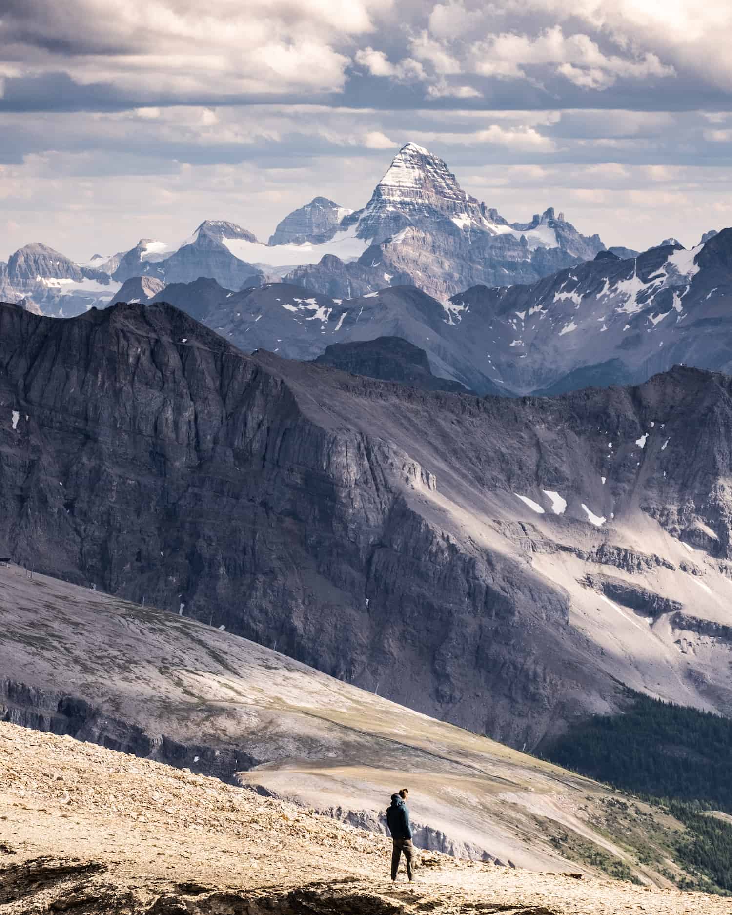
Sunshine Meadows

- Length: 8 km (varies)
- Duration: 2-4 Hours
- Elevation Gain: 309 meters
- Best Time To Go: Summer
- Trailhead: Banff Sunshine Village Gondola
This is a solid hike with tremendous views and none of the work because the real leg work is done by the Sunshine Village Gondola, which gains most of your elevation for you. From the village, hikers have many options from the convenient base. Situated in an alpine meadow, the trails are flanked by a sea of wildflowers.
The classic hike to Rock Isle Lake follows the shoreline of two lakes, crosses an alpine larch forest, and has a spectacular viewpoint that looks out to Kootenay National Park. To walk through these alpine meadows feels like something out of a fairytale; it is sublime.
Note that there are many trail variations up here, ranging from 2km to over 8km long, so it really just depends on what you’re in the mood for!
Grassi Lakes (Canmore)

- Length: 4.3 km
- Duration: 1-2 Hours
- Elevation Gain: 203 Meters
- Best Time To Go: Summer
- Trailhead: Grassi Lakes Trailhead
Grassi Lakes is a hike in Kananaskis just outside Canmore. However, it’s closer to the town of Banff than many of these hikes, so we thought it best to include it. Grassi Lakes is one of our favorites and the one hike we’ve probably done the most in the Canadian Rockies, as we live just down the road from the trailhead in Canmore. Our visiting family loves this walk as it’s easy on the knees—perfect for kids, the elderly, and leashed pets!
About five kilometers south of town, the lakes are easy to reach. It makes for a fabulous picnic spot, as it’s one of the most picturesque places around Canmore. The lake water is remarkable, and the lakes are in a wonderful natural setting with tremendous views. It’s one of the most popular hikes in the region, and few wonder why. Due to the popularity, we suggest avoiding on weekends or holidays.
Note that in the summer, there are two trails – an “easy” and a “hard” trail, though neither is too difficult. We recommend anyone of reasonable fitness to take the hard trail.
Fairview Lookout

- Length: 2.2 km
- Duration: 1 Hour
- Elevation Gain: 155 Meters
- Best Time To Go: Year-Round
- Trailhead: Lake Louise
The Fairview Lookout trail is a short, sweet Lake Louise hike that provides great views over Lake Louise from elevation. It’s a great option to escape the crowds at the Lake Louise lakeshore and get a great view of the lake in winter and summer.
The hike’s highlight is an excellent platform that provides views of the impressive and historic Chateau Lake Louise Hotel. Don’t expect any view on the way up as it’s all forested, but the lookout platform from the top is a lovely view worth the effort. This short hike is great for kids or those who are less mobile. When you finish, you can enjoy lunch at the Chateau or a canoe paddle on Lake Louise.
The Rockpile

- Length: 0.8 km return
- Duration: 30 minutes
- Elevation Gain: 30 Meters
- Best Time To Go: June – October
- Trailhead: Moraine Lake
I hesitate to call this one a full hike, it is a classic for any first-time visitor to Banff. The Rockpile Trail leaves from the Moraine Lake Lakeshore, and in just 120 steps up, you’ll have a grand view of Moraine Lake. It’s aptly named the “twenty-dollar viewpoint” as Moraine Lake was once on the Canadian $20 bill.
If you’re going to Moraine Lake, it’s a classic that cannot be skipped.
Want a Bit More Distance and Elevation?
This was just a list of our favorite easy hikes in Banff. For those after a few tougher hikes, check out our list of epic Banff hikes. The sky is the limit with mountain summits and hikes in the Canadian Rockies. It would take a lifetime of exploring to check off everything the mountain range offers.
Hiking Gear We Recommend

It’s tough to beat the comfort and stability of the Speedgoat. A more technical shoe would be the Salomon X Ultra.

It’s always jacket season in the Rockies. We always carry a down jacket on every adventure.

This nifty clip from Peak Design secures a camera to my backpack strap for easy reach. No more digging in the backpack!


A lightweight backpack is perfect for most hikes in the Rockies. We suggest keeping it simple and carrying the basics.

In case of emergencies, we carry a GPS-enabled emergency beacon. Solid for regular backcountry users.
Advice on Hiking in Banff

- If this is your first time hiking in the Rockies, pick an adequate hike for your fitness level, plan for plenty of time, pack water and food, and don’t be afraid to turn around. We have a great post about what to wear hiking.
- For longer hikes, set a turnaround time at the departure. Whenever we set out for an objective, we determine when to turn around to arrive at the parking lot or campsite by dark. I recommend not hiking in the dark as it’s easy to get lost, and it’s not fun in bear country.
- Always carry bear spray if you plan to hike in the park. We carry ours in the neighborhood, and bears have been known to stroll through town and busy parking lots. Always practice wildlife awareness when on a trail, and please give animals space.
- Pets must be leashed at all times.
- Regarding times, remember that your mountain fitness is different from the gym. The low end of the times in this post is a constant fast-paced uphill with little to no breaks and a brisk pace downhill. Most hikers should plan for a middle-of-the-road time with the estimated duration.

If you’re heading to Western Canada soon make sure to check out our interactive map with over 450 spots to help you plan!
- ✅ Hiking trails with links to trails & insider tips you won’t find online
- ✅ Our favorite photo spots, scenic views, waterfalls, must-visit attractions, and even swimming holes
- ✅ Our favorite restaurants, coffee shop & local spots that many skip.
- ✅ We add as we explore ourselves. That means we add new points every month!
- ✅ Map works with Google Maps!
- ✅ Pre built itineraries you can replicate,
- ✅ Discover spots via an ad-free interactive map and a grid, full of original content and videos
- ✅ Use on the go, mobile-first, offline-friendly, and made for the road.
- ✅ Local insights you won’t find on Google or AI – all in one place!


Hello Cameron! My name is Andres , great info. on your blog!
I’m curious! Is my first time in the rockies.. and I’m planning some hiking with my family.. we are : my wife 45, kids 10 and 11 and me 39.
I’m thinking of going to moraine lake in the early morning hours( 5 am ish) to witness sunrise.. and because I’m taking my family , I bringing a very small gas propane burner to serve them breakfast, and I have this concern of attracting wild animals ( bears included)due to the smell ..do you think this is a bad idea? Should I be concerned? In the menu is coffe ,hot chocolate, scramble eggs and breakfast sausages( just 4 tiny small sausages!)… super if u can read this and give me an idea…
Thank you very much!
Hey Andres! You’ll be fine to cook breakfast at Moraine Lake. Don’t worry about wildlife! Although, you should pack everything out and make sure trash goes in the bear bin trashcans. Sounds like the perfect morning!
Hi Cameron
Like your blog and read all of them…very useful!
We are going to the Rockies next week, first time. Very sad of the smoke…do you have any idea when will be a good time for pictures, and any suggestions you might have?
Appreciate your input, thank you! Evelyn
Thanks so much! Hope you have a fantastic trip. Yes, the wildfire season has been rough this year. The time for pictures depends on the weather, but if you want the best experience, I would advise elevation early in the morning or evening. A drive up the Icefields Parkway in the morning or evening might give you clear skies or at least better visibilty.