20 Alberta Hikes That Will BLOW You Away

While some may think of Alberta as only plains, oil, and cattle farming, the province has much more to offer, especially when it comes to hiking. There are so many stunning Alberta hikes that it would be nearly impossible to complete them all, let alone list them.
However, we still want to try and attempt to showcase as many as possible. From the Canadian Rockies to the Badlands, here are 20 of the most beautiful hikes in Alberta for you to enjoy.
When is the Best Time to Hike in Alberta?

Some of these Alberta hikes can be completed year-round. As Alberta isn’t exactly a warm-weather destination, and it feels like winter lasts from October to May, the best time to hike in Alberta is the summer. Many of these hikes below are best completed between June and September, with some higher elevation hikes noted best in July and August.
Parks Pass
It’s important to note that to complete these Alberta hikes, you will need either a Parks Canada or Kananaskis Conservation Pass to recreate in the parks. You can purchase a Parks Canada pass at any park gate; you need a Parks Canada pass to visit any national park in Canada.
Parks Canada Day Pass Rates
| Pass Type | Rate |
|---|---|
| Adult | $12.25 |
| Senior | $10.75 |
| Youth (up to 17) | Free |
| Family/Group (7 Persons) | $24.50 |
Or you can buy them from Parks Canada in advance online. If you’re staying in Alberta for over a few days, I highly recommend a Discovery Pass. A Parks Canada Discovery Pass gets you entrance to all Parks Canada destinations for the year and is only $168 for a family.
Parks Canada Discovery Pass Fees (Yearly Pass)
| Pass Type (Yearly Pass) | Rate |
|---|---|
| Adult | $83.50 |
| Senior | $71.50 |
| Youth (up to 17) | Free |
| Family/Group (up to 7 Persons) | $167.50 |
The Best Alberta Hikes: Banff
Healy Pass

- Length: 20.9 km
- Duration: 5-7 hrs
- Elevation Gain: 890 meters
- Difficulty: Moderate
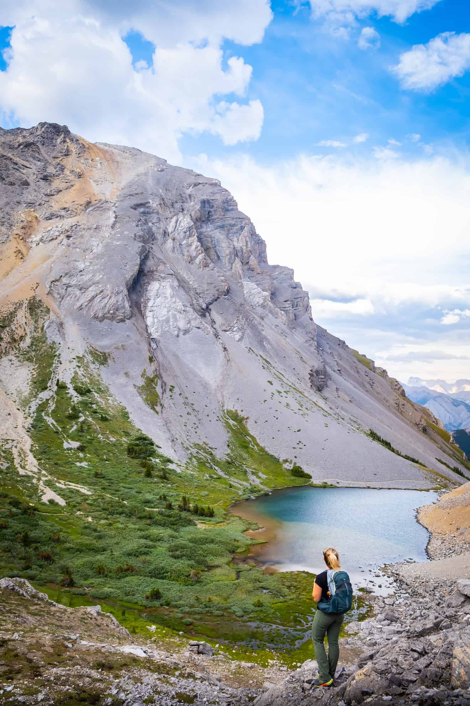
Healy Pass is one of our favorite Alberta hikes – so much so that we often enjoy it multiple times a year. This hike is in Banff National Park and can be done as a day or multi-day hike, given its length. Beginning at the Sunshine Village parking lot, Healy Pass is one of the best-maintained trails in the entire park.
The trail starts with a gradual climb through a lushly shaded forest. After 8km, the forest gives way to a gorgeous alpine meadow, and a vast expanse of wildflowers in the summer, or golden larch trees in the fall.

The trail’s apex is past the meadow, which provides fantastic views of Mount Monarch and the surrounding peaks. In the distance, you can see Mount Assiniboine, one of the most picturesque peaks in the Rockies.
If there is one negative, it’s the long approach to this hike. Walking through the forest for nearly 7 km without many views can feel a bit like a slog. We highly recommend hiking Healy Pass in July and August when the wildflowers are everywhere or in late September, as it’s one of the best larch hikes in Alberta!
If you want a little extra and have the energy, you can hike down to Egypt Lake. Or backcountry camp at the Egypt Lake campsite and tackle Phaorah Peak (scramble).
A Guide to Hiking the Healy Pass Trail
Mount St. Piran

- Length: 12.2 km
- Elevation Gain: 918 meters
- Duration: 3-6 hours
- Difficulty: Hard
Another one of the best hikes in Alberta that often gets overshadowed is Mount St. Piran. Many visitors venture to Lake Louise and opt to do a little hiking. The most popular hike is Lake Agnes Teahouse, followed by the Beehives and often Devil’s Thumb. However, many visitors don’t attempt or even think about Mount St Piran. This is a nice summit to bag if you already have a few other Canadian Rockies hikes under your belt.

If you’ve already hiked up to the Lake Agnes Teahouse, consider continuing on to the Little Beehive and then continuing up Mount St. Piran. While the Teahouse and Little Beehive are easy Lake Louise hikes, Mount St Piran is classified as an easy scramble. However, there is little actual hands-on scrambling involved.
Though it is steep, the views over Mount Fairview and Lake Louise are worth the climb. The route up to Mount St Piran falls between a scramble and a hike. It’s an excellent early-season objective once the snow melts off the avalanche slopes, as there is no exposure on the route.
How to Hike the Mount St Piran Trail
Parker Ridge

- Length: 1.5 km
- Elevation Gain: 269 meters
- Duration: 2-4 hrs
- Difficulty: Easy
After completing Parker Ridge, it shot right up to one of my favorite hikes along the Icefields Parkway. It doesn’t get much better than the Parker Ridge Trail, which offers amazing views with relatively little effort. I usually hike a lot longer and harder for half as good views.
Since this hike is between Banff and Jasper along the Icefields Parkway, I recommend this hike when you are already making the four-hour drive between the two mountain towns. At under 2km and less than 300 meters of elevation gain, Parker Ridge can easily be incorporated into an Icefields Parkway road trip itinerary.

The Parker Ridge hike is pretty straightforward on a well-trodden trail, the entire 269 meters up. Nothing complicated or technical about this Banff hike, and no scrambling is involved making it an excellent hike for newer hikers. It’s great for the entire family, those with mobility issues, or anyone who just wants a nice, leisurely day out with fantastic glacier views!
The finale of this hike is reaching the ridge and taking in views of the impressive Saskatchewan Glacier! This hike is best completed in July and August, as there is a lot of snow at other times of the year.
How to Hike Parker Ridge Trail
Mount Bourgeau

- Length: 21.7 km
- Elevation Gain: 1,731 meters
- Duration: 5 – 10 hours
- Difficulty: Difficult
Mount Bourgeau is a 2,931-metre-tall mountain not far from Downtown Banff. Sound intimidating? Don’t worry! It’s one of the more accessible mountain summits in the Canadian Rockies – as long as you don’t mind a long day out!
At 22 km and 1731 meters of elevation gain, the sheer length and elevation gain require strong legs and stamina. However, it is not technical or physically terrible, and no scrambling is needed to summit the mountain, a rarity for many peaks in Alberta.
On the way to the peak, you cross the lovely Bourgeau Lake, witness stunning views from Harvey Pass, and on a clear day, you can see Mount Assiniboine. If summiting Bourgeau sounds like too long a day, you have other options! You can choose to go just to Bourgeau Lake or Harvey Pass, each cutting out a large chunk of the hike.
We completed the trip up to the summit in around six hours, with over a half-hour at the summit. Unless you’re trail-running, I wouldn’t expect to complete it much sooner, as the average time is around eight hours. This is a full-day hike, so come prepared with lunch, water, and snacks.
Best Alberta Hikes: Jasper
Valley of Five Lakes

- Length: 4.8 km
- Elevation Gain: 172 meters
- Duration: 1 -2 hours
- Difficulty: Easy
The Valley of Five Lakes is a classic Jasper hike that’s probably the most popular in the park—and for good reason! Hikers come to gaze at the five picturesque lakes along the trail. It’s a flat, well-developed trail, so it’s easy for all ages and abilities to enjoy the lakes and their varying shades of blue and green.
How to Hike the Valley of the Five Lakes
Whistler’s Summit

- Length: 3.7 km
- Elevation Gain: 251 meters
- Duration: 1-2 hours
- Difficulty: Moderate
From the top of the Jasper Skytram, visitors can enjoy the views over Jasper and continue to summit Whistler’s Mountain, which is great for those who want a bit of hiking. Quite honestly, unless you hike from the base, the Jasper Skytram assists most of the way up the mountain, but a 20-30 minute hike further will get you to the summit. It’s more or less a must-do in Jasper! On a clear day, you can even see Mount Robson – the highest mountain in the Canadian Rockies.

Just because this is an assisted hike doesn’t mean it’s completely effortless. At just about 200 meters of elevation gain, it takes some work to reach the summit, and you’ll feel accomplished! For those who want a bit more of a challenge and a bit of scrambling, consider continuing on to Indian Ridge!g
The Skyline

- Length: 46 km
- Elevation Gain: 1380
- Duration: Multiday
- Difficulty: Difficult
Not to be confused with the Sulphur Skyline Trail, The Skyline is a highlight in Alberta. However, at nearly 50km, it’s best done as an ultra-trail run or multiday backpacking trip. It’s also a point-to-point trek, so it requires a bit of planning, but it’s such a stunning hike it had to be mentioned on this list. It’s best for those who want to plan something longer than a day hike.
The Skyline is a breathtaking trail that crosses several mountain passes and stays at an elevation from Maligne Lake to the Maligne Canyon. The views are surreal, and there is little wonder why this is a world-famous backcountry trip.
Best Alberta Hikes: Kananaskis Country
Arethusa Cirque

- Length: 5 km
- Elevation Gain: 350 m
- Duration: 2-3 hours
- Difficulty: Easy
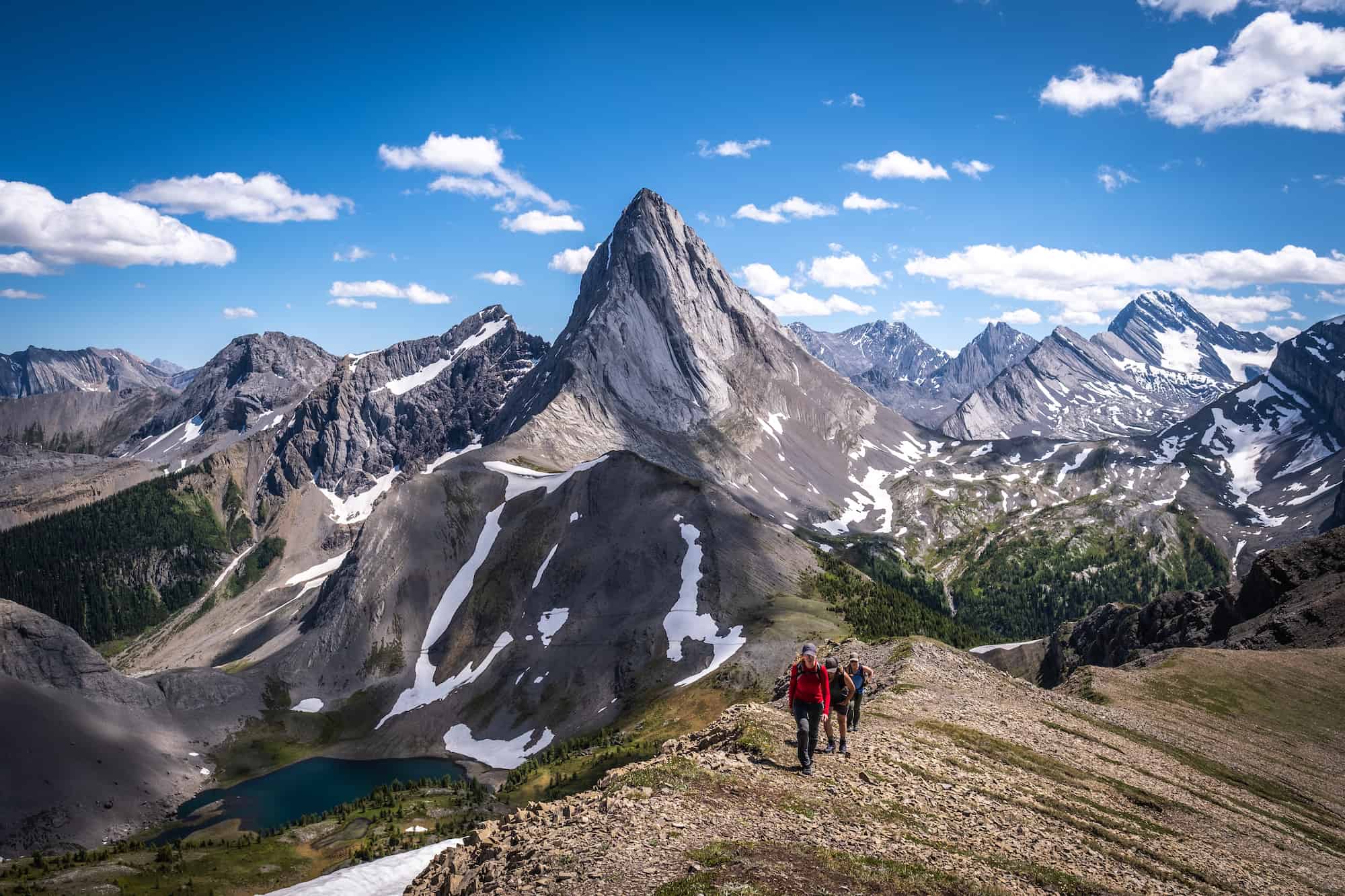
Arethusa Cirque is a family-friendly hike in Kananaskis Country that we decided to tackle in larch season after completing Pocaterra Ridge and Ptarmigan Cirque nearby. I wasn’t expecting much from this hike near Calgary, but I was absolutely stunned by how beautiful this one was.
This is a simple hike that almost anyone can complete with out-of-this-world views of Mount Arethusa, Storm Mountain, and Mount Tyrwhitt. We highly recommend completing this hike in late September when the larches turn golden. Arethusa Cirque is a loop hike, and I suggest taking this loop trail clockwise. One very steep and loose section is better to ascend than descend – especially with children or older hikers.
Tent Ridge

- Length: 10.6km
- Elevation Gain: 750m
- Duration: 4-6 hours
- Difficulty: Moderate
Tent Horseshoe Ridge is one of my favorite hikes in all of Alberta. This beautiful loop trail is just an hour’s drive from Canmore in the Spray Valley. Thanks to social media, it’s become quite popular in recent years, but even with the crowds, it’s still a stunner. Tent Ridge Horseshoe is a 10-kilometer loop trail with one short scramble section. It’s not too tricky; even a newer hiker could complete this hike.
While the whole loop hike is lovely, the real showstopper comes at the end (if you take the trail clockwise, which we recommend), as you get views of the Spray Lakes with Mount Nester perfectly situated behind.
Sarrail Ridge Via Rawson Lake

- Length: 11.3km
- Elevation Gain: 1,066m
- Duration: 3-6 hours
- Difficulty: Moderate-Difficult
Rawson Lake is a beautiful Alberta lake suitable for a wide range of abilities, and when combined with Sarrail Ridge, it makes for a relatively quick, classic hike in the Canadian Rockies. The views, particularly from Sarrail Ridge, are stunning, but you’ll have to put in plenty of work to get them.
This hike starts at the Upper Kananaskis Day Use Parking lot and is one of those perfect Kananaskis day hikes you’ll remember forever. Along the trail to Rawson Lake, you’ll cross bridges over waterfalls and get beautiful views over Upper Kananaskis Lake.

For a mild adventure, the hike to Rawson Lake is a great beginner’s hike in Peter Lougheed Provincial Park. It’s about a 300-meter elevation gain and can be done early or late season or even in the winter. While you certainly won’t be disappointed by the views at Rawson Lake, you can continue hiking for grander views.
Continue up to Sarrail Ridge (summer only), and you’ll enjoy views of those sweet baby-blue Kananaskis Lakes. Though beware, it’s a very steep dirt trail up to the ridge. The ridge climb is a bit of a slog, going straight up an avalanche chute and through prime grizzly bear habitat. As always, hiking with bear spray and proper footwear is essential. Once you reach the ridge, you can look over Upper and Lower Kananaskis Lakes and Mount Indefatigable.
How to Hike Sarrail Ridge Via Rawson Lake in Kananaskis
Smutwood Peak
- Length: 17.9km
- Elevation Gain: 961m
- Duration: 5 – 9 hours
- Difficulty: Moderate-Difficult, mainly towards the summit.
Smutwood Peak is one of our favorite Kananaskis hikes and one of Alberta’s best. This hike is best done with a group, as it is in prime grizzly country with plenty of trees at the beginning (and end of the walk).
Along the hike, you’ll pass an incredible waterfall, and once you get into the alpine meadow, the views are amazing. Hopefully, you’ll get a glimpse of the many whistling marmots! There are some steep sections of this hike. Going up Smuts Pass is relentless for 2 km, but it lightens up again as you come across two alpine lakes at the saddle.
The real challenge is the final push-up to the top of Smutwood Peak (not to be confused with Mount Smuts). There is some hands-on scrambling involved to reach the summit of Smutwood Peak, but once you reach the summit, you’ll enjoy expansive views of Mount Birdwood.
Mount Allan
- Length: 15.8km
- Elevation Gain: 1,485 m
- Duration: 6-9 hours
- Difficulty: Easy, but long
Mount Allan is a popular hike in Kananaskis, but it is a long day with significant elevation gain. With a distance of 15.8 km and an elevation gain of 1,485 meters, Mount Allan is no short hike. This hike takes you to a mountain summit without scrambling or anything technical. I love the hike up Mount Allan because you gain elevation steadily, almost the entire time, without any extremely steep sections.
Mount Allan can be a point-to-point hike or an out-and-back hike. Mount Allan via Centennial Ridge links Ribbon Creek and Dead Man’s Flats. You can do the entire traverse for a long day, especially great for those with two cars. We only had one car and decided to start our journey at Centennial Ridge trailhead, where we had a steady but easy incline up into the valley and would return the same way.

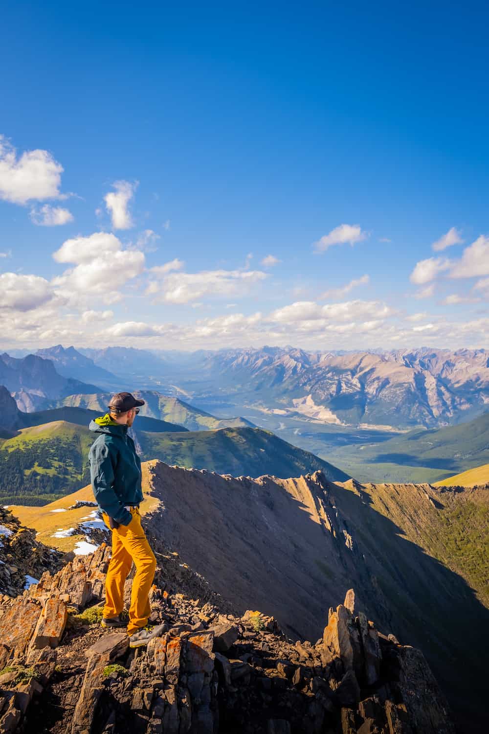
The views start here and never end. From the car park to Centennial Ridge, it is about 1.5-2 hours. Most people stop when they reach the ridge, but it’s worth it to keep pushing and go for the summit of Mount Allan and get views towards Kananaskis Country to the south and Canmore to the Northwest.
Along the hike to the final summit of Mount Allan, you’ll see huge pinnacles that look unworldly. These features make this hike one for the books alone. You can continue to Dead Man’s Flats (if you have set up a car shuttle) or turn around for an easy and enjoyable hike down. The summit of Mount Allan sits at 2819 meters, making it the highest maintained trail in the Rockies, and it is very well maintained!
Best Alberta Hikes: Waterton
Bear’s Hump

- Length: 2.3 km
- Elevation Gain: 214 meters
- Duration: 30 minutes – 2 hours
- Difficulty: Easy
If you want a short and sweet hike with glorious views, you can’t get much better than Bear’s Hump in Waterton National Park. It’s a great Canadian Rockies hike as any age and ability can make it up to Bear’s Hump. At the top of this hike, you get stellar views of Upper Waterton Lake and Glacier National Park in Montana.
This hike is accessible right from the town of Waterton and can be done in under an hour. That means you can enjoy your entire day in the park and head up here with a few sundowners at sunset.
How to Hike Bear’s Hump in Waterton National Park
Lower Bertha Falls

- Length: 5.3 km
- Elevation Gain: 200 m
- Duration: 1-2 hours
- Difficulty: Easy
The Bertha Falls hike is similar to Bear’s Hump in terms of difficulty, but you are rewarded with waterfall sprays instead of views of another country. This is a great kid-friendly hike with easy terrain and minimal elevation gain.
Along the way to the falls, you’ll get plenty of views of Waterton Lake. Once you reach the falls, you can turn this into a longer hike and continue to Bertha Lake, another 3km, 400 meters, and 21 switchbacks away. The reward is a brilliant green-blue lake!
Crypt Lake Trail

- Length: 20km
- Elevation Gain: 900 meters
- Duration: 4-8 hours
- Difficulty: Moderate
The Crypt Lake Trail has been named one of the world’s most thrilling hikes and one of Canada’s best trails. Every summer, eager hikers reach the trailhead from Waterton Township via boat, excited to tackle the trail for a full day. The trail climbs 900 meters over 10 kilometers, gaining ridges as you get views of Mount Bosworth and Vimy Ridge.

The exciting trail requires hikers to climb cliffsides, climb an exposed ladder, and squeeze through a natural tunnel. It sounds scary, but don’t worry; it’s nothing any mildly experienced hiker can’t tackle. The trail ends at beautiful Crypt Lake, just north of the Montana/Canada border. Bring a bathing suit to cool off after a hard day’s work. All in all, this is one of the best things to do in Waterton.
How to Hike the Crypt Lake Trail
Best Alberta Hikes: Drumheller
Drumheller Hoodoos Trail

- Length: 1.4 km
- Elevation Gain: 82 m
- Duration: 30 min – 1 hour
- Difficulty: Easy
Drumheller is one of the best spots for hiking in Western Canada, but it often gets overlooked by hikes in Banff. It’s famous for its Badlands terrain and for its abundance of hoodoos.
What is a “hoodoo,” you ask? They are geological formations of craggy columns carefully sculpted by the feats of nature and, indeed, a sight to behold. These tall, thin rock pillars are formed by wind erosion, giving them a unique shape with a wide, flat top and stunning striations.
The column is often made of softer stone shaped by the elements over millions of years, topped with the much harder stone, which keeps the structure intact. Also referred to as fairy chimneys or earth pyramids, they have been compared to giant stone mushrooms or Mars monuments made by aliens. The best place to see the hoodoos up close is on the ‘Hoodoos Trail,’ which is an easy 1.4-kilometer loop trail near Drumheller! It’s great for kids and families and will leave any hiker with a smile.
Horsethief Canyon

- Length: .8 km
- Elevation Gain: 22 m
- Duration: 30 minutes
- Difficulty: Easy
Horsethief Canyon is named for the nomadic horse thieves who once hid their stolen livestock here. Hiking here will quickly take you back to a lost world that makes you feel like you are in a Wild West movie. Horsethief Canyon is located on the Dinosaur Trail, though it’s not much of a defined trail and more of a go wherever the view takes you type of hike!
Horseshoe Canyon

- Length: 3.9 km
- Elevation Gain: 113 meters
- Duration: 1-2 hours
- Difficulty: Easy
Horseshoe Canyon is similar to Horsethief Canyon, with unworldly views, but has a defined trail to follow! This huge U-shaped canyon gives you a true sense of the beauty of the badlands. The maroon-striped canyon walls reveal layers dating to when dinosaurs roamed the Earth in the Cretaceous period.
Other Great Hikes
Vision Quest

- Length: 6.4 km
- Elevation Gain: 856 m
- Duration: 4-6 hours
- Difficulty: Difficult
If you enjoy a Western Canada road trip, I can’t recommend venturing into David Thompson Country enough! One of the main highlights here is Abraham Lake, and Albertans head here year-round to take note of its wonders. In the winter, it’s made Instagram famous for its frozen methane bubbles.
In the summer, people head to Abraham Lake to camp, paddle, and hike. The most popular hike in the area is Vision Quest. I know it sounds like an 80s video game. It’s not virtual reality, but a hike that provides absolutely astonishing views over Abraham. Hiking/scrambling Vision Quest involves climbing 850 meters of elevation gain and 6.3 km. It is a great day out for those looking to get away from the crowds in Banff!
Hiking Gear We Recommend

It’s tough to beat the comfort and stability of the Speedgoat. A more technical shoe would be the Salomon X Ultra.

It’s always jacket season in the Rockies. We always carry a down jacket on every adventure.

This nifty clip from Peak Design secures a camera to my backpack strap for easy reach. No more digging in the backpack!


A lightweight backpack is perfect for most hikes in the Rockies. We suggest keeping it simple and carrying the basics.

In case of emergencies, we carry a GPS-enabled emergency beacon. Solid for regular backcountry users.
Advice On These Hikes

- If it’s your first time on these hikes, take a conservative approach – read our post for beginner hikers in the Canadian Rockies, too. Pick an adequate hike for your fitness, plan for plenty of time, pack water and food, and don’t be afraid to turn around. If you want to learn more about what to wear hiking, we have a great post.
- Always carry bear spray if you plan to hike in Alberta. Always practice wildlife awareness on a trail, and please give animals space.
- Leash your dogs. Dogs must be kept on a leash at all times while hiking in National Parks.
- There is no cell service for many of these hikes, a Garmin Inreach, or something similar could save your life!
If you have any other questions, leave a comment or see our Canadian Rockies travel guide for more articles about photography spots, lakes, hikes, and everything else.

If you’re heading to Western Canada soon make sure to check out our interactive map with over 450 spots to help you plan!
- ✅ Hiking trails with links to trails & insider tips you won’t find online
- ✅ Our favorite photo spots, scenic views, waterfalls, must-visit attractions, and even swimming holes
- ✅ Our favorite restaurants, coffee shop & local spots that many skip.
- ✅ We add as we explore ourselves. That means we add new points every month!
- ✅ Map works with Google Maps!
- ✅ Pre built itineraries you can replicate,
- ✅ Discover spots via an ad-free interactive map and a grid, full of original content and videos
- ✅ Use on the go, mobile-first, offline-friendly, and made for the road.
- ✅ Local insights you won’t find on Google or AI – all in one place!


