The Canadian Rockies boast some of the most beautiful hiking trails in the world. Fortunately, you can reach many Banff hikes without a car by using the public bus system, shuttles, or even by walking from town. While you may not be able to access every trail in the park, you also won’t be short of options.
From family-friendly walks to steep scree slopes and scrambles, there is a hike for everyone and every mode of transportation to complete your car-free trip to Banff. We’ve compiled some of our favourite trails around Banff, Lake Louise, and neighbouring Canmore with notes on how to access each without a rental car. Familiarize yourself with the buses before setting out, and then lace up your hiking boots for an astounding adventure. Happy trails!
Easy Banff Hikes Without A Car
1. Tunnel Mountain
- Length: 4.5 km
- Duration: 1 – 2 hours
- Elevation Gain: 266 meters
- Difficulty: Easy
- Best Time To Go: Year-Round
- How To Get Here: Walk from downtown Banff
A Rockies classic, Tunnel Mountain is one of the most popular and accessible hikes in Banff. If you want to achieve a summit with minimal effort, Tunnel Mountain is your best bet. The hike moves slowly up the mountain through several switchbacks and offers various viewpoints over the Bow River and Mount Rundle. Given the proximity to town and relative ease, the trail can get pretty busy during the summer, so hike at sunrise or sunset if seeking solitude.
The lower mountain trailhead is only a few blocks from downtown Banff, meaning those staying in town can easily walk from their hotel and then walk back in time for a patio lunch.
Read the Full Guide – Hiking Tunnel Mountain
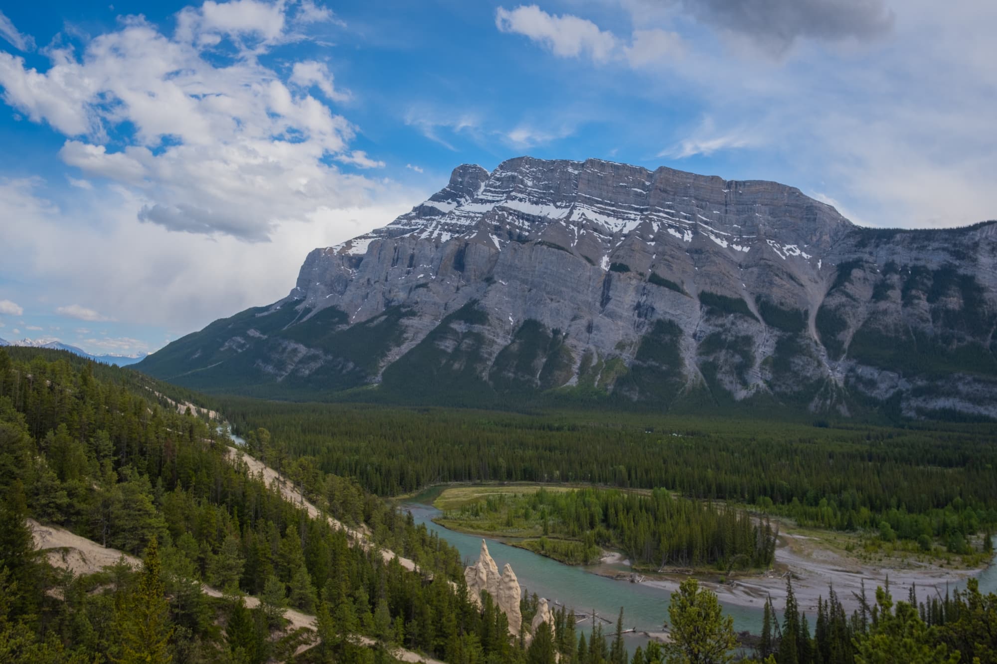
2. Surprise Corner to Hoodoos
- Length: 9 km (4.5 km one way, plus 1.5 with a walk from Banff Avenue)
- Duration: 2-3 hours
- Elevation Gain: 295 meters
- Difficulty: Easy
- Best Time To Go: Year-Round
- How To Get Here: Walk from downtown Banff or take Roam Route 2
Another scenic hike with a trailhead a mere 1km from downtown Banff, the Hoodoos Trail meanders alongside the Bow River behind Tunnel Mountain. Bookended by popular viewpoints, Surprise Corner and Hoodoos Lookout, the 4.5km forested path offers a leisurely excursion suitable to all levels.
While only a short walk from downtown Banff, the Hoodoos trail feels surprisingly peaceful and secluded. You may encounter various locals along the way, both wildlife and active humans climbing or mountain biking. For a shorter excursion, hike one way and then return by bus from the Tunnel Mountain Campground stop across the road from the Hoodoos lookout.
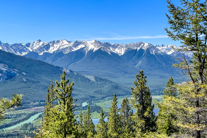
3. Stoney Lookout
- Length: 4 km
- Duration: 1-2 hours
- Elevation Gain: 226 meters
- Difficulty: Easy
- Best Time To Go: June – October
- How To Get Here: Norquay Summer Shuttle (free)
Stoney Lookout Trail is a short but sweet hike that leads to a viewpoint overlooking the town of Banff. The hike begins at the Mount Norquay parking lot and winds through the forest to reach lookouts over the Bow Valley and towards Cascade Mountain. The mellow, shady trail is a great option for hot days or little legs and can be much quieter than other trails so close to town.
Mt. Norquay’s free summer shuttle makes it possible to access this Banff hike without a car. In 2024, the free shuttle operates from June to October 13. While in the area, consider a journey up the sightseeing chairlift and enjoy lunch at the Cliffside Bistro following your hike.
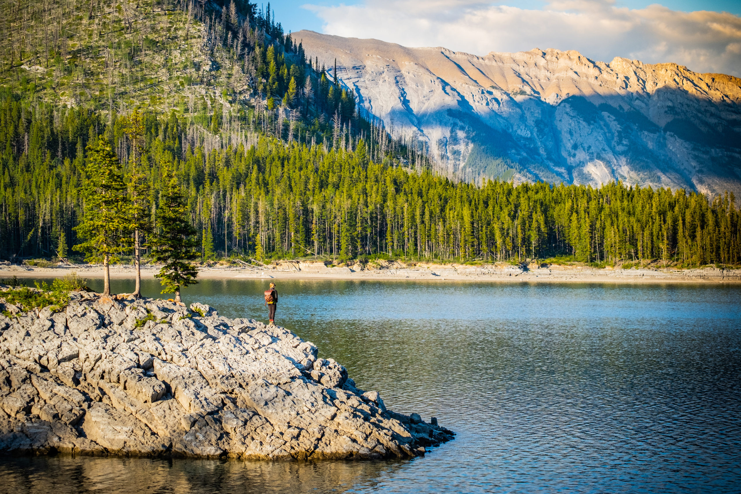
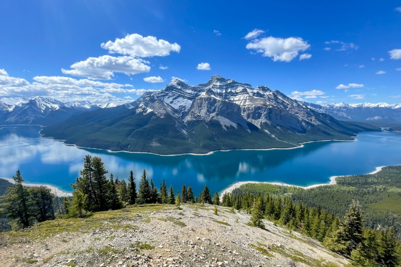
4. Minnewanka Lakeside / Stewart Canyon
- Length: Around 6 km
- Duration: 1 – 4 hours
- Elevation Gain: Varies depending on distance
- Difficulty: Easy to moderate
- Best Time To Go: June – September
- How to Get Here: Take Roam Transit Route 6 to Lake Minnewanka
Marvel at one of Alberta’s largest lakes by following the lakeshore trail that winds around the mystical Lake Minnewanka. You can continue along the shore for as long as you like, but reaching the Stewart Canyon Bridge is a great objective for novice hikers, with a total out-and-back distance of 6 km and very minimal elevation gain. Crowds thin out the further you hike, and continuing beyond the bridge will provide superb views over the alluring lake and surrounding mountains.
Minnewanka’s lakeside trail is an excellent early season hike as the lower elevation keeps it snow-free for longer periods. Hikers can easily reach this trail by boarding Roam Transit’s Route 6 and enjoying the scenic 25 minute trip along Lake Minnewanka Scenic Road to the Lake Minnewanka stop.
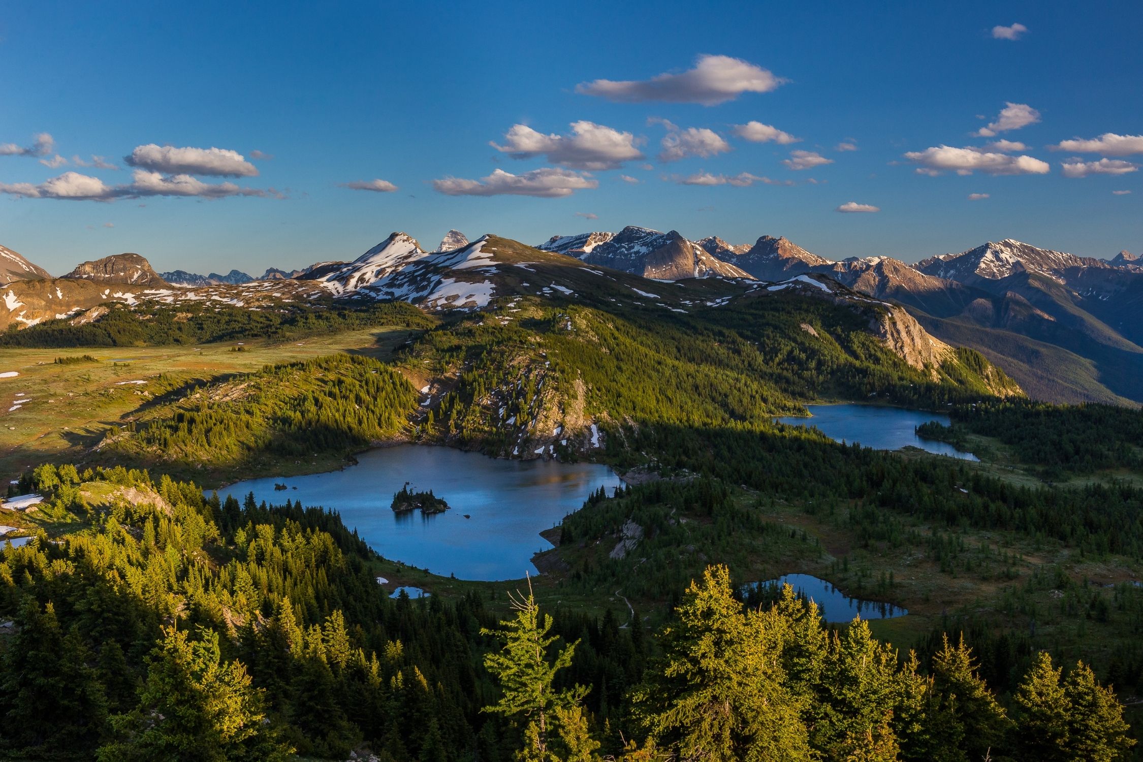
5. Sunshine Meadows
- Length: Up to 8 km
- Duration: 2 – 5 hours
- Elevation Gain: 309 meters
- Difficulty: Easy (moderate without the gondola)
- Best Time To Go: July – September
- How To Get Here: Sunshine Summer Shuttle
One of Banff’s most popular ski resorts puts their lifts to good use in the summer months, whisking visitors uphill to an alpine paradise known as Sunshine Meadows. On this gondola-assisted hike, you’ll gain most of the elevation by riding the Sunshine Village Gondola and the Standish Chairlift. Hikers visiting Banff on a budget could walk up the access road instead (for an added distance of 5km and elevation gain of 500m).
Once at Sunshine Village, various well-marked trails encircle the rolling hills and idyllic lakes. On a clear day, you’ll be able to spot Mount Assiniboine in the distance, affectionately dubbed the ‘Matterhorn of the Rockies.’ Undoubtedly, the best time to hike Sunshine Meadows is when the wildflowers bloom in July. You can even book a guided hike to learn more about area’s spectacular flora and fauna.
Sunshine Village runs a free shuttle while the sightseeing gondola operates (June 28 to September 22, 2024) to transport visitors from Banff to the gondola base.
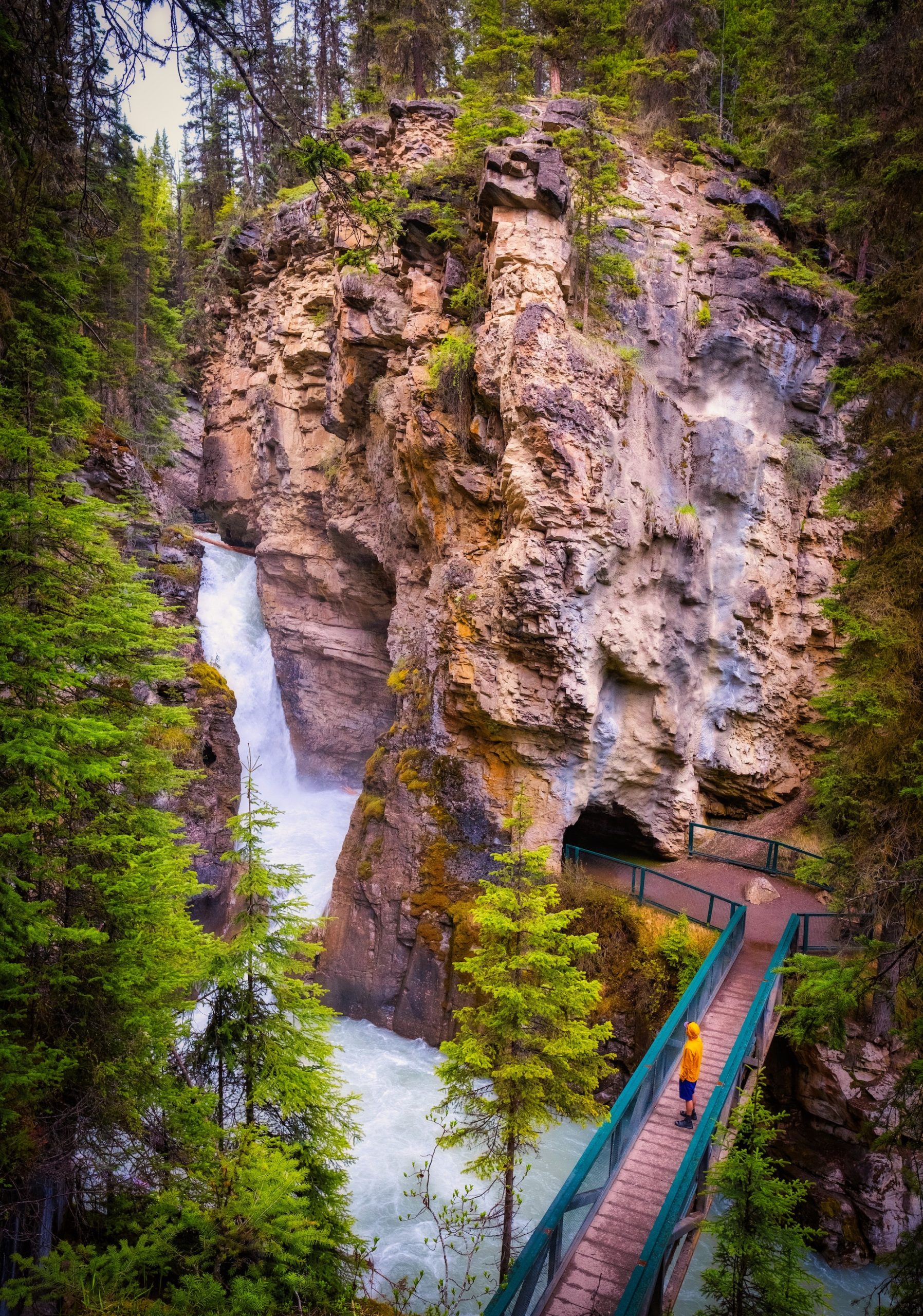
6. Johnston Canyon (and Ink Pots)
- Length: 5 km to 11.7 km
- Duration: 2 – 5 hours
- Elevation Gain: 215 to 608 meters
- Difficulty: Easy (moderate if extending to Ink Pots)
- Best Time To Go: Year-Round
- How to Get Here: Roam Transit Route 9 or Hop on Banff
Johnston Canyon showcases the wonders of erosion and roaring aqua waters. A comfortable walkway winds along the canyon wall above the glacial waters, providing access to hikers of varying ages and abilities. Visitors are quickly rewarded with views of the Lower Falls, but continuing to the impressive Upper Falls is worth the extra effort. To make this a moderate hike, follow the onward trail beyond that eventually leads to an open alpine meadow and the unique Ink Pots, a series of colourful, bubbling mineral springs.
Johnston Canyon can become quite packed during mid-day, especially in the summer on a weekend, so try to catch buses at the start or end of the day. Getting from Banff to Johnston Canyon is made easy by using the Roam Route 9 Bus that runs in the summer, or by booking the Hop On Hop Off Tour Bus. Lastly you can look into booking an ebike and hike tour that lets you bike the Bow Valley Parkway before enjoying the hike through the canyon. You could also bike this on your own by renting a bike at Banff Cycle during the 1A closure that happens every May, June, and September. Remember to lock up your bike as you hike!
Read the Full Guide – Hiking Johnston Canyon
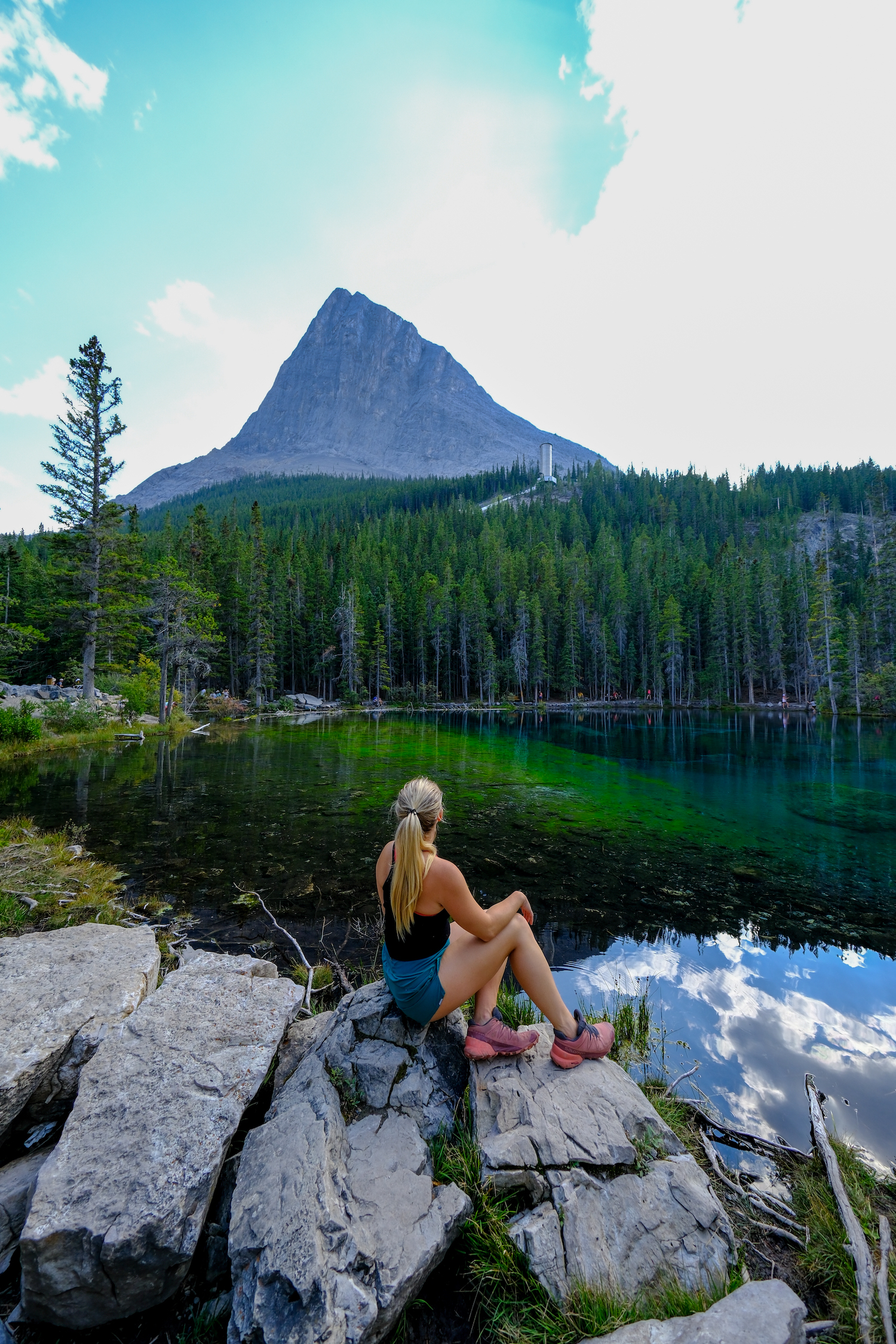
7. Grassi Lakes
- Length: 4.3 km
- Duration: 1-2 hours
- Elevation Gain: 203 meters
- Difficulty: Easy
- Best Time To Go: Year-Round
- How to get Here: Roam Transit Route 12 (weekend service)
This family-friendly hike is a Canmore classic, and an excellent excursion for those based in Banff’s neighbouring mountain town. Featuring two mesmerizing lakes, a cascading waterfall, and views over Canmore, it’s no wonder that Grassi Lakes is one of the most popular hikes in the Bow Valley.
From the trailhead, there are two options to reach the lakes: a gradual incline along a wide trail or rocky stairs alongside the waterfall. Both are fairly mellow but those with young children in tow may find the easy route more appealing.
For summer 2024 (until September 15), a new Roam Transit route (Route 12) will operate between downtown Canmore to Grassi Lakes on Fridays, Saturdays, Sundays, and statutory Mondays, with stops at Quarry Lake and the Canmore Nordic Centre. Grassi Lakes’ beauty well known and the trail can attract quite a crowd, especially when buses are scheduled so we recommend tackling in the morning or evening.
Read the Full Guide – Grassi Lakes Hike
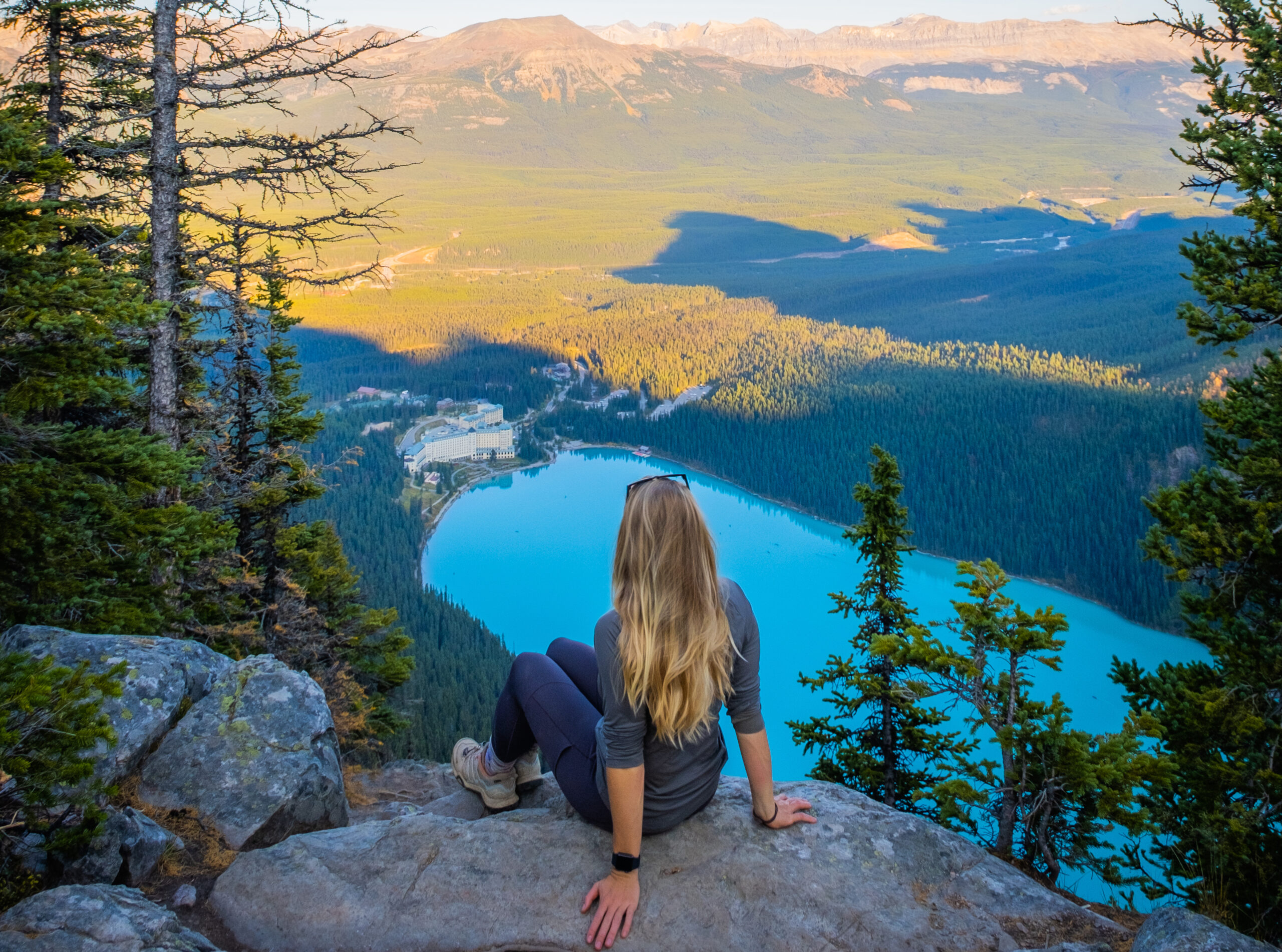
8. Lake Agnes Teahouse
- Length: 6.8 km
- Duration: 2 – 4 hours
- Elevation Gain: 385 meters
- Difficulty: Easy
- Best Time To Go: Summer-Fall
- How to Get Here: Roam Transit Route 8X or Hop on Banff
Many visitors to Lake Louise opt to complete the iconic hike to the historic Lake Agnes Teahouse. From the shore of Lake Louise, the trail winds through the forest along gentle switchbacks. Along the way, you’ll catch glimpses of the surrounding peaks and have the chance to rest at Mirror Lake before reaching a gushing waterfall below the famed teahouse.
Perched on shores of a pristine alpine lake, the Lake Agnes Teahouse provides an enchanting scene and an excellent spot for breakfast or lunch. Arrive early and bring cash if wishing to make a purchase from the teahouse, which opens at 8 a.m.
You can get here by using the Roam Route 8X, though this should be booked in advance in the summer as getting to Lake Louise is quite popular. Alternatively, book the Hop On Bus that makes a stop at Lake Louise, and plan for the hike to take 4 hours.
Read the Full Guide – Lake Agnes Teahouse Hike
9. Consolation Lakes
- Length: 5.8 km
- Duration: 1 – 2 hours
- Elevation Gain: 255 meters
- Difficulty: Easy
- Best Time To Go: June – October
- How to Get Here: Roam Transit Route 8X then take Parks Canada Lake Connector, Hop on Banff, Wow Banff, or Private Shuttle tour with hotel pickups
Consolation Lakes is a wonderful detour while visiting Moraine Lake. It doesn’t take very long to complete the trail, which is quieter than many others in the area. Follow the signed path that forks away from the Rockpile. You’ll pass the scree slopes from the Tower of Babel and continue through old-growth forest before arriving at an alpine field and wetlands with Consolation Lakes at its end.
Scrambling across the boulder field is a fun challenge, or simply admire the backside perspective of the Ten Peaks, Mount Babel, and Mount Fay from the lakeshore.
Getting to Moraine Lake and hiking to Consolation Lakes requires advance planning and shuttle hopping, so is best suited to those who are already planning an excursion to Moraine Lake.
10. Fenland Trail
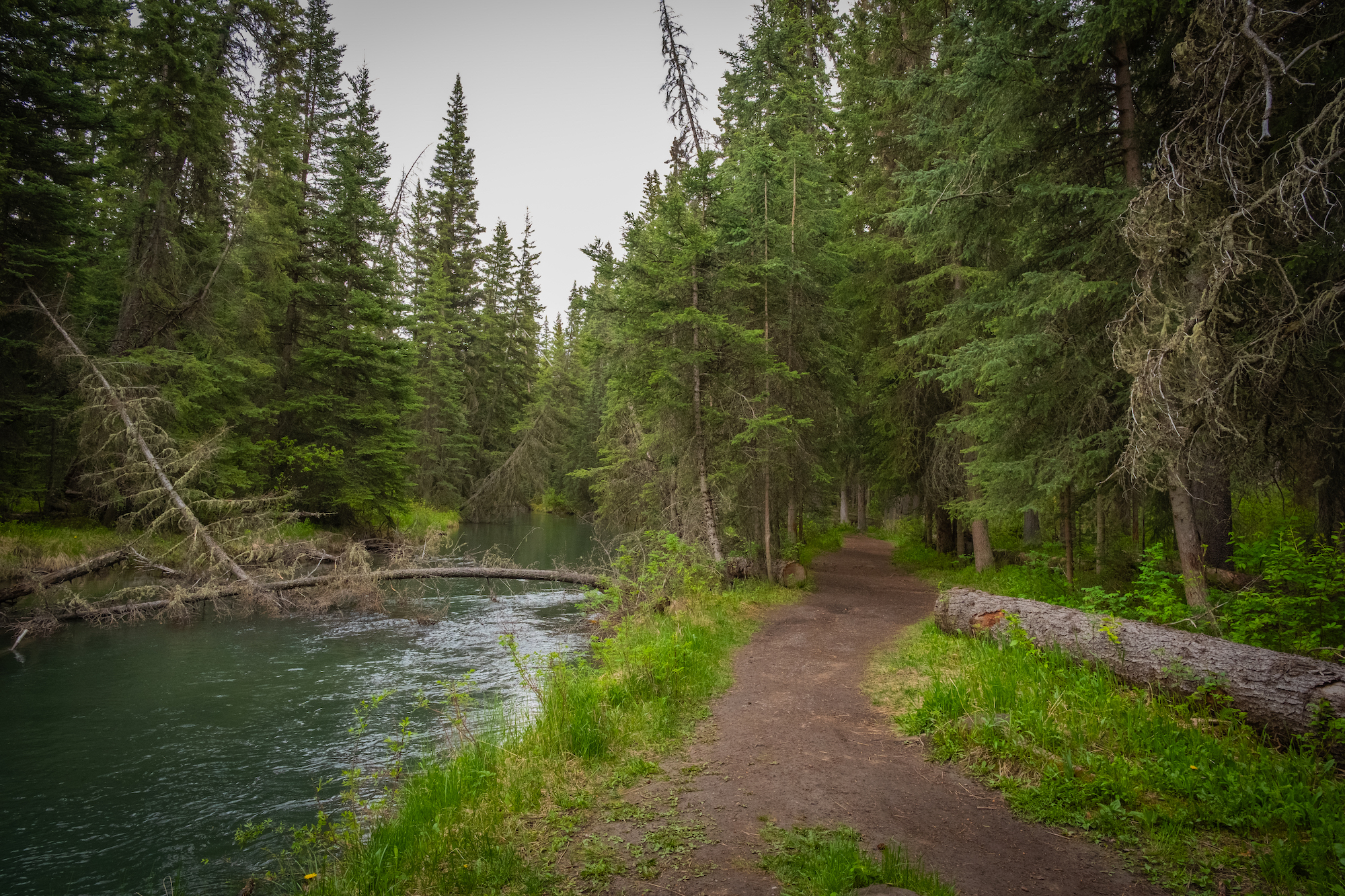
- Length: 1.8 km
- Duration: > 1-Hour
- Elevation Gain: Minimal
- Best Time To Go: Year-Round
- How to Get Here: Walk or bike from Downtown Banff.
Fenland is an easy loop through the forest just outside of town. It’s also a great way to connect the town with a walk to the docks of Vermilion Lakes for a beautiful morning or evening hike. The trail is scenic and loops through the forest along Echo Creek, a tributary that connects Vermilion Lakes and the Bow River.
It’s a relaxing walk that offers some pleasant river views and a few mountain views of Mount Norquay. If you’d like to spot some wildlife, this is an excellent trail, as lots of birds nest in the marshlands of Vermilion Lakes, and elk often rut along Echo Creek. It’s not much of a hike, but more of a short walk out of town.
Moderate Hikes Without A Car
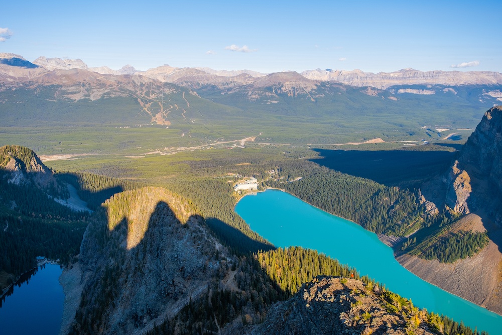
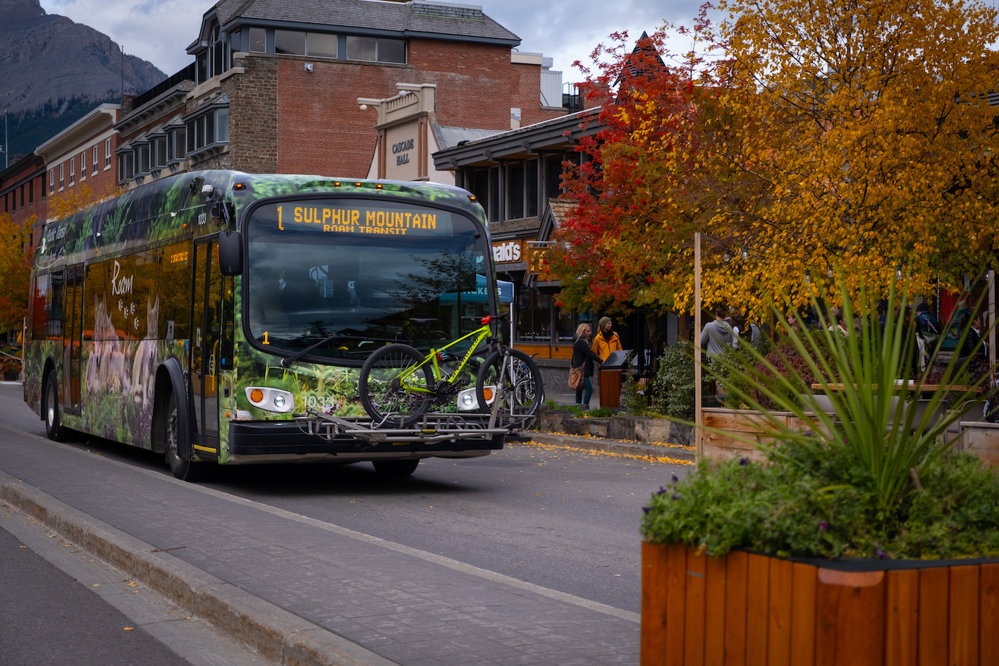
11. Sulphur Mountain
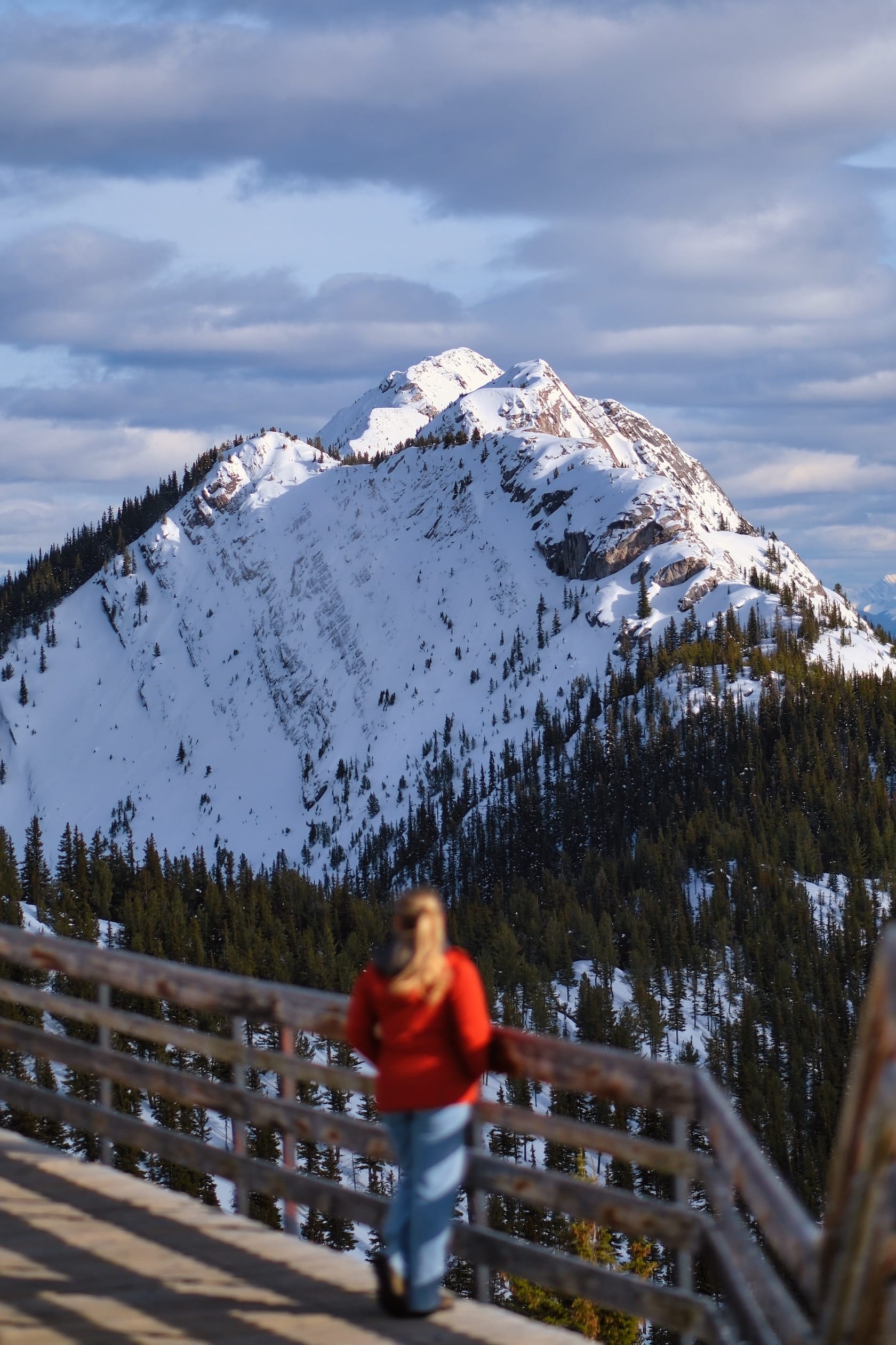
- Length: 10.1 km
- Duration: 2 – 4 hours
- Elevation Gain: 744 meters
- Difficulty: Moderate
- Best Time To Go: Year Round
- How To Get Here: Roam Transit Route 1
While the summit of Sulphur Mountain can be reached in a few minutes with the gondola, the trail offers a highly rewarding alternative for those willing to work for views. In addition to glorious panoramas, Sulphur Mountain boasts an array of summit amenities that feel luxurious after an uphill trek. Once at the top, wander down the boardwalk to the historic Cosmic Ray Station.
Sulphur Mountain is a great trail for first-time visitors to Banff or novice hikers keen to attempt a longer trail. From the well-marked trailhead, the dirt track winds up the mountain below the gondola in a series of mellow switchbacks. The end of day is a spectacular time to enjoy the summit as the sun casts golden light across the valley and you can enjoy an aptly named Sulphur Mountain Session Ale on the Peak Patio.
Given the popularity during the summer months, busing from downtown Banff to the trailhead is recommended even for those with a car. If you have to wait for a bus after descending, consider treating tired legs to a soak at the Banff Upper Hot Springs.
Read the Full Guide – Hiking Sulphur Mountain
12. Healy Pass
- Length: 20.9 km
- Duration: 5-7 hours
- Elevation Gain: 890 meters
- Difficulty: Moderate
- Best Time To Go: July (wildflower season) or end of September (larch season)
- How to Get here: Sunshine Summer Shuttle
This long, gradual trail leading to an alpine meadow with expansive views is another Banff classic. While not technically challenging, the hike to Healy pass is long. Starting from the Sunshine Village parking lot, the trail traverses through shaded forest for 7km before opening out to a glorious meadow.
From here, the path winds uphill for a few more kilometers to the top of Healy Pass, where you can enjoy the impressive views back towards Sunshine and the distant Mount Assiniboine. While this trail makes a superb hike all summer and fall, it truly shines in July when the wildflowers bloom.
To reach the Healy Pass trailhead without a car, hop on the free shuttle that serves the Sunshine gondola (between June 28 to September 22, 2024). Best to catch one of the early shuttles so you have ample time to complete the trail.
Read the Full Guide – Hiking Healy Pass in Banff
13. Lady Macdonald Teahouse
- Length: 8.7 km
- Duration: 4 – 6 hours
- Elevation Gain: 1,015 meters
- Difficulty: Moderate
- Best Time To Go:
- How to Get here: Roam Transit Route 5C
This popular Canmore hike provides a bird’s eye view over town and the surrounding peaks, including Ha Ling, the Rundle range, and the iconic Three Sisters. Starting from Cougar Creek, the trail zig-zags uphill through the forest to emerge on the rocky shoulder of Mount Lady Macdonald.
You won’t actually find an operational teahouse, only an abandoned wooden platform. For refreshments, head back downhill and enjoy the Iron Goat’s beautiful patio while you wait for the return bus. Although Mount Lady Macdonald’s true summit may seem tempting from the ‘teahouse’ platform, it requires exposed scrambling along a narrow ridge and is best left to experienced scramblers.
Many Canmore locals can simply walk to this trail from their doorstep, but the local Roam bus 5C also provides car-free access from the center of town and most Canmore hotels. Note that sections of this area have ongoing construction work, stay up to date here.
14. Beehive Circuit
- Length: 12 km
- Duration: 4 – 7 hours
- Elevation Gain: 620 meters
- Difficulty: Moderate
- Best Time To Go: June – October
- How to Get here: Roam Transit Route 8X or Hop on Banff
For some of the best views over Lake Louise, hike beyond Lake Agnes to one or both of the Beehives. The full Beehive Circuit combines Mirror Lake, Lake Agnes, the Little Beehive, and the Big Beehive, offering a long but rewarding day hike for those with the stamina and motivation to see all the sights.
Of course, you could limit yourself to one Beehive, but it is hard to choose when both offer equally panoramic perspectives. Like other hikes that begin at the shore of Lake Louise, the Beehive Circuit can be accessed without a car by reserving a ticket on Roam Transit or the hop-on-hop-off bus that travels up the scenic Bow Valley Parkway.
Read the Full Guide – Beehive Circuit Hike
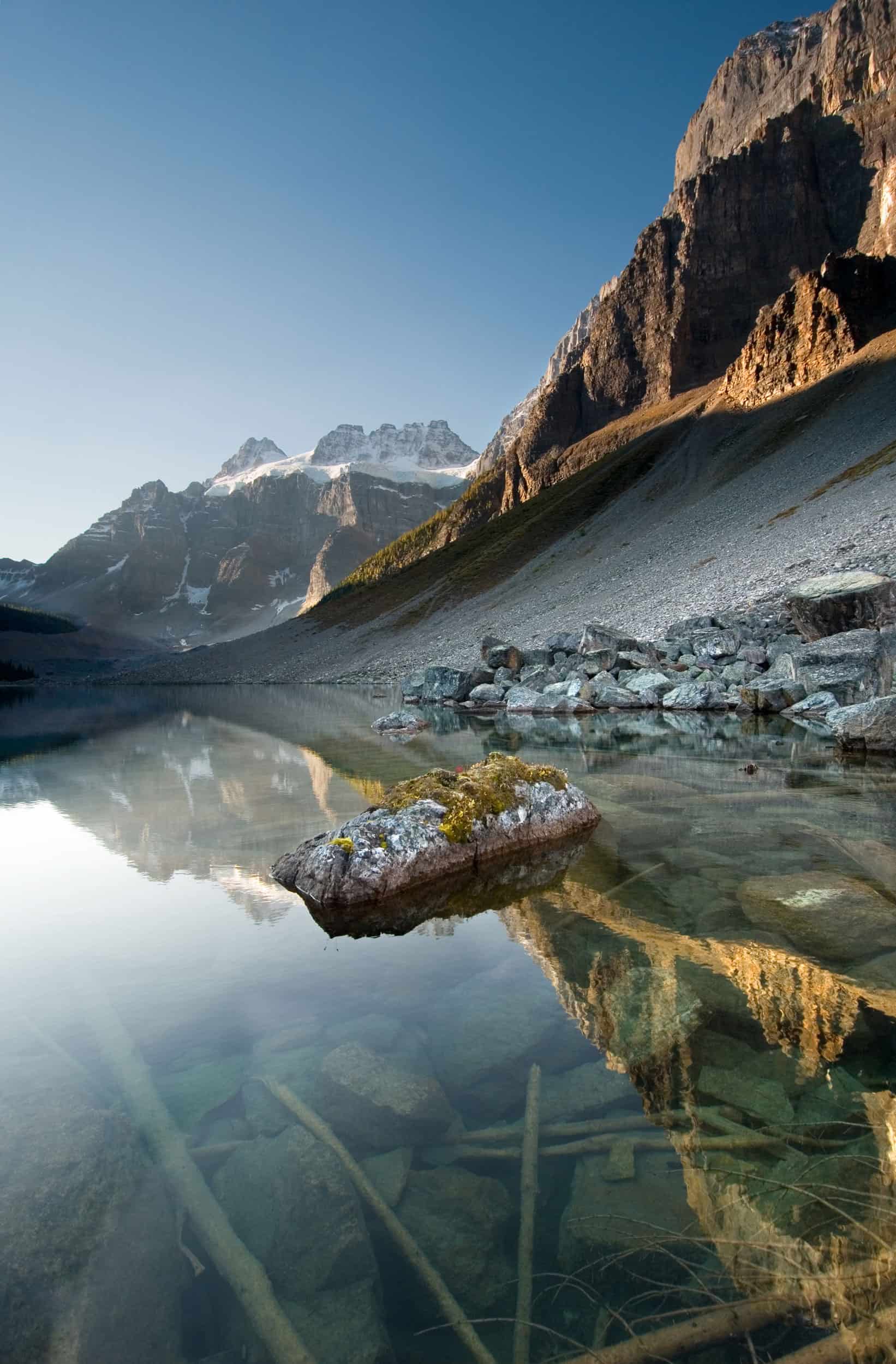
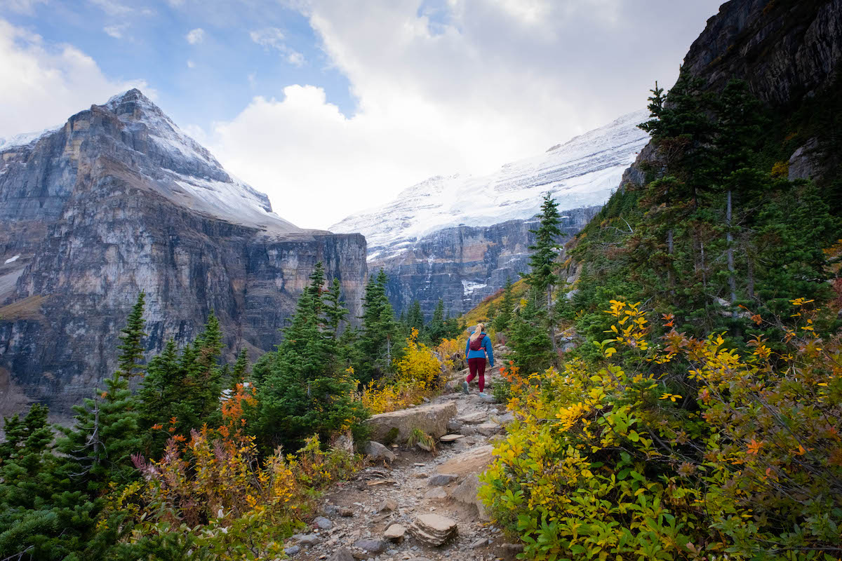
15. Plain of Six Glaciers
- Length: 13.8 km
- Duration: 4 – 5 hours
- Elevation Gain: 487 meters
- Difficulty: Moderate
- Best Time To Go: June – October
- How to Get here: Roam Transit Route 8X or Hop on Banff
This stunning Lake Louise hike follows the shoreline into the glacial valley beyond. While the six glaciers that give this trail its name have retreated considerably, their powerful legacy is evident and its humbling to witness how they’ve carved the Rockies landscapes.
Along this moderate out-and-back trail you’ll travel the full length of Lake Louise to see the ancient ice that produces its surreal shades of blue. A quaint teahouse is nestled in the valley, offering hungry hikers a steaming cup, baked good, or lunch before the return journey. An unmaintained trail extends for an additional kilometer beyond the teahouse to a final viewpoint towards Abbot Pass.
Read the Full Guide – Plain of Six Glaciers Hike
16. Saddleback Pass / Saddle Mountain
- Length: 7 km to 8.2 km
- Duration: 3 – 5 hours
- Elevation: 595 to 658 meters
- Difficulty: Moderate
- Best Time To Go: June – October (end of September for larches)
- How to Get here: Roam Transit Route 8X or Hop on Banff
To escape the crowds of Lake Louise, head to Saddleback Pass. The well-marked trails behind the boathouse will take you through lush forest, steadily ascending the side of Fairview Mountain. You’ll be treated to valley views along the way, culminating with the tranquil Sheol Valley at the top of the pass.
Many turn back here, the end of the official trail, but you can continue for another 500m over a boulder field to bag one of the easiest peaks in the Rockies and marvel at the grandeur of Mount Temple towering over Paradise Valley. A more strenuous alternative to Saddle Mountain would involve summitting the rocky slopes of neighbouring Fairview Mountain.
If visiting at the end of September, Saddleback Pass is one of the most underrated larch hikes in Alberta and sees a fraction of the crowds of nearby Larch Valley.
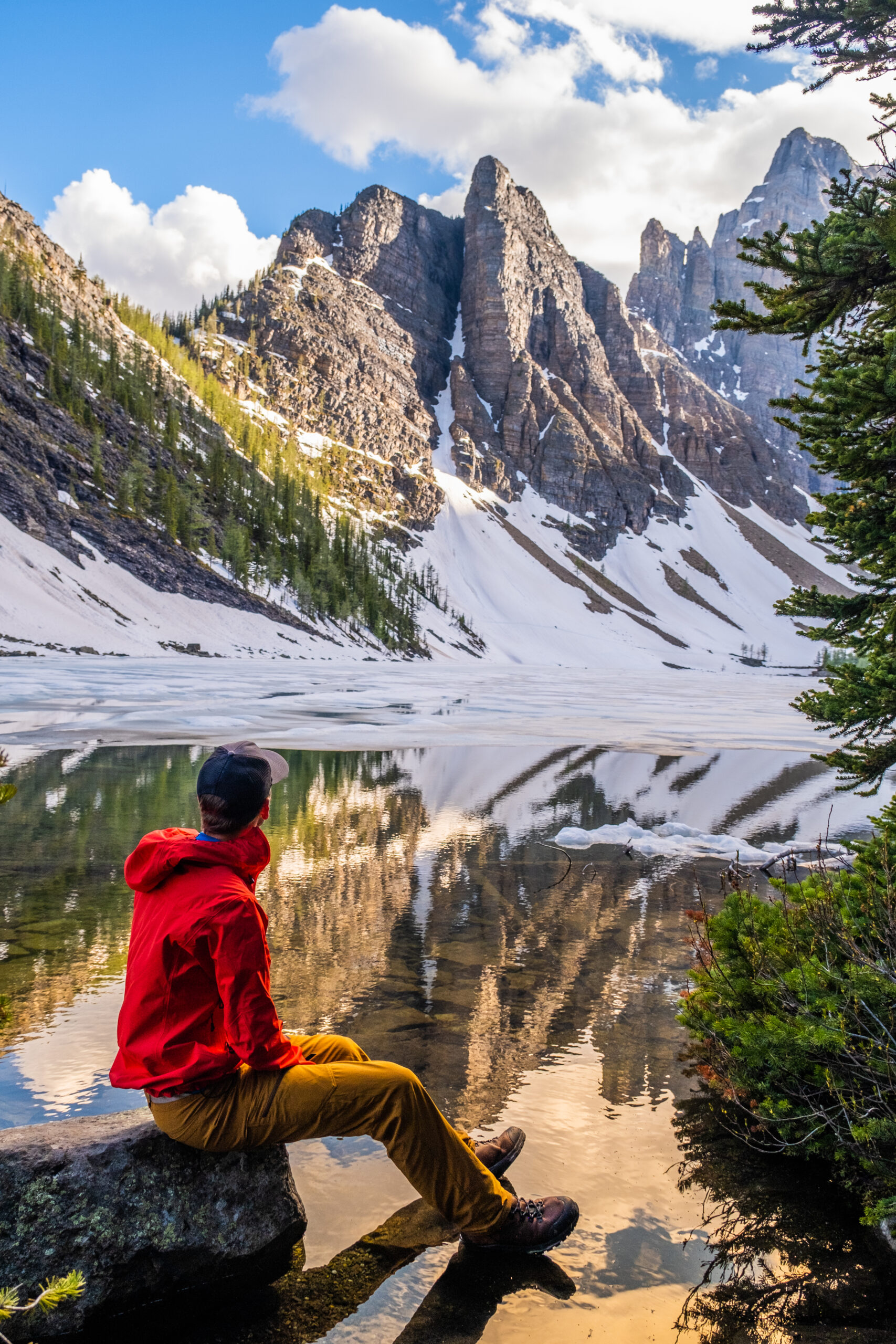
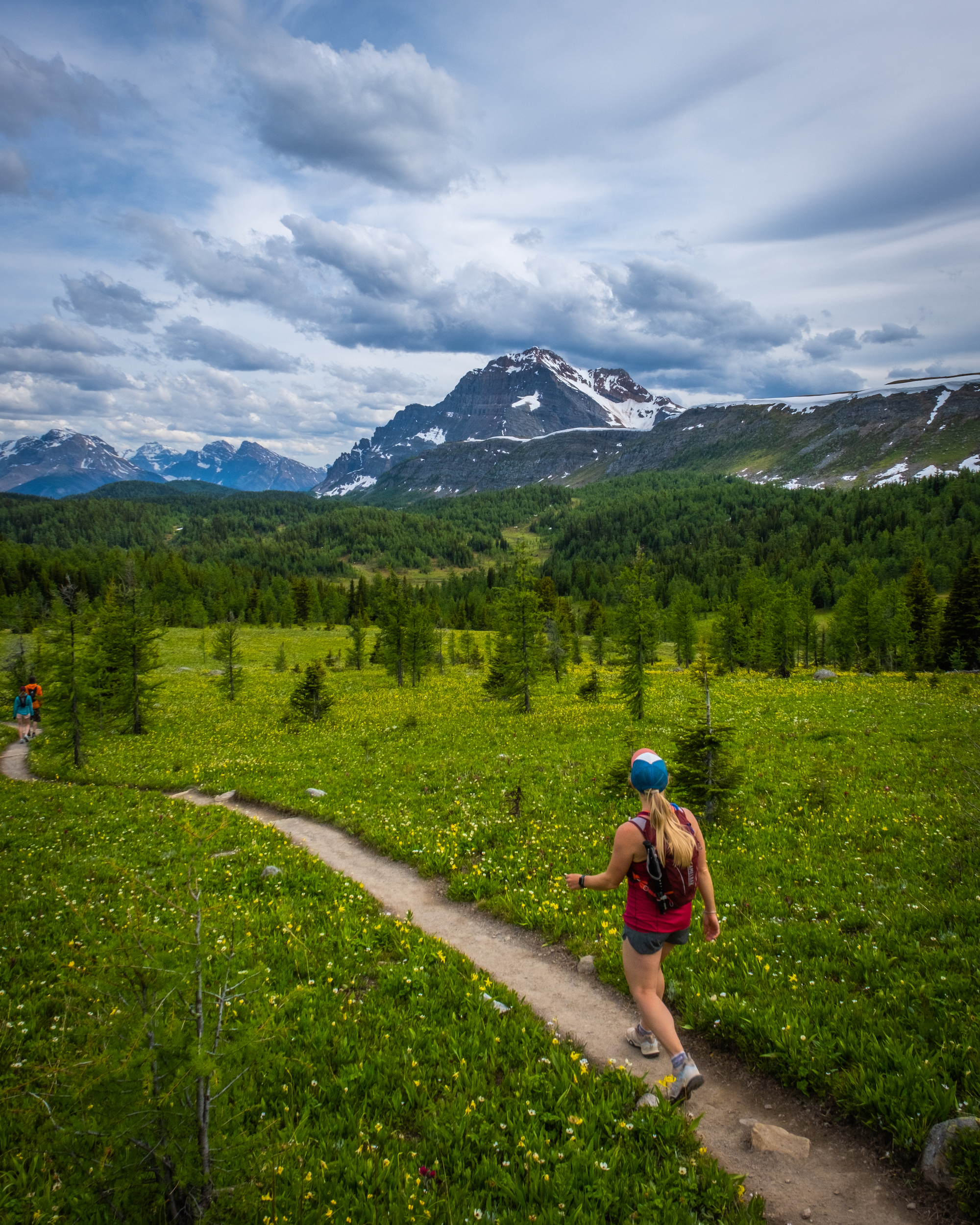
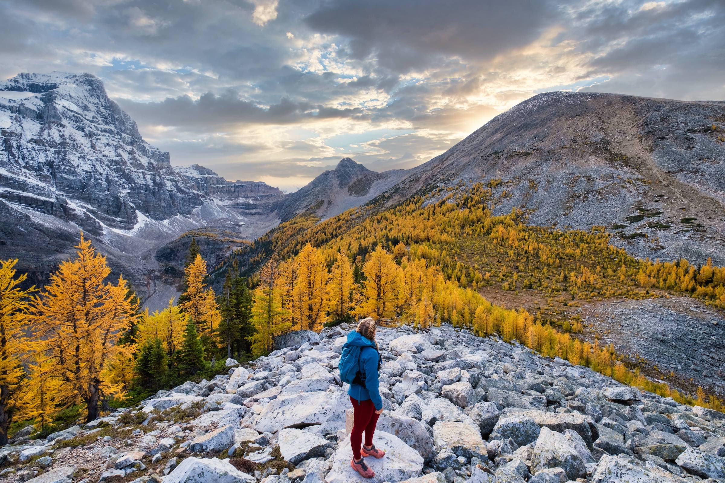
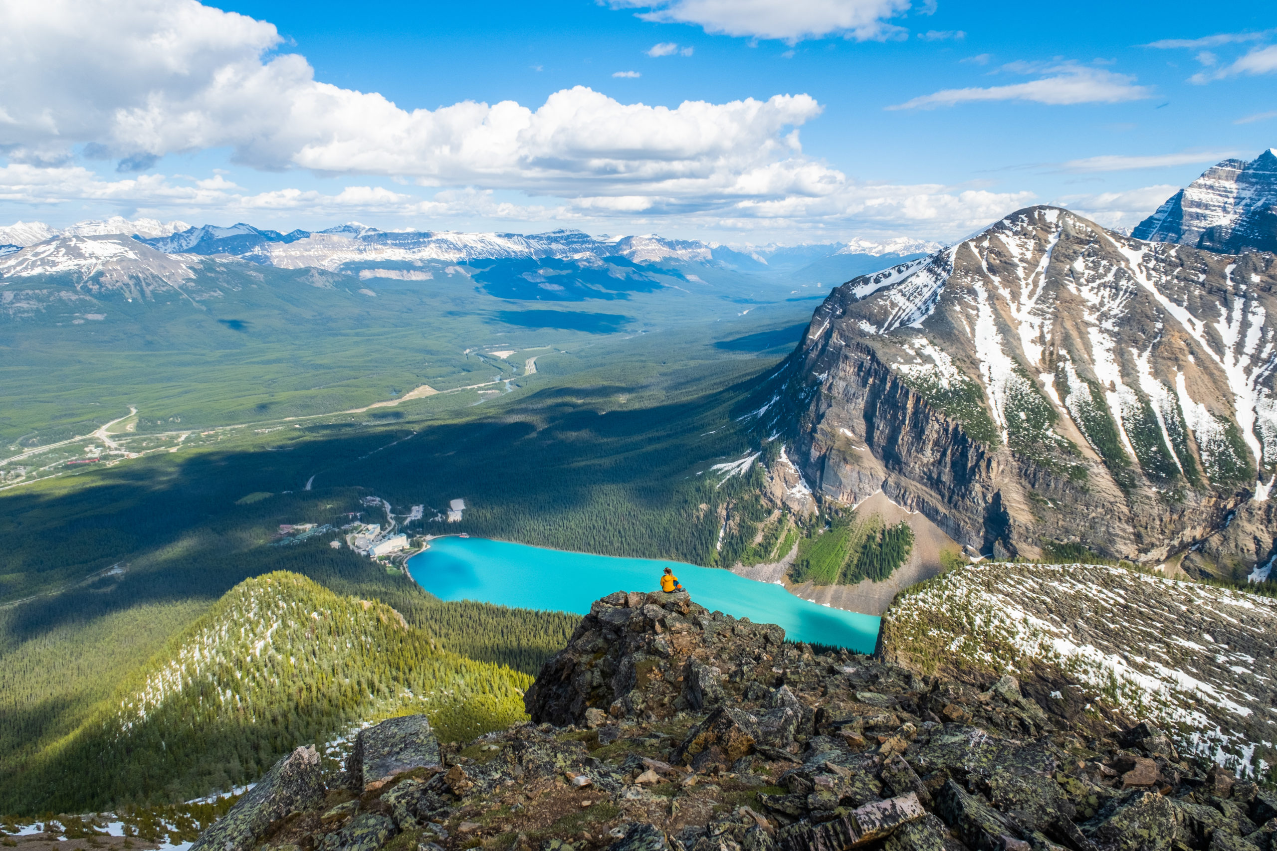
17. Larch Valley / Sentinel Pass
- Length: 11.6 km
- Duration: 3 – 6 hours
- Elevation Gain: 792 meters
- Difficulty: Moderate
- Best Time To Go: July – September
- How to Get here: Roam Transit Route 8X, then Parks Canada Lake Connector, or Roam Route 10 in the larch season, Via Via Shuttle
Perhaps the most quintessential hike in the Canadian Rockies and one of the most popular hikes from Moraine Lake, Sentinel Pass via the Larch Valley trail delivers inspiring scenes of jagged, glacier-capped mountains. The trail ascends from the lakeshore up well-maintained and well-trafficked switchbacks to Larch Valley, an alpine meadow encircled by towering peaks. For an added challenge, continue up the rocky slope at the end of the valley to Sentinel Pass and sweeping views.
For a few short weeks in the fall, Larch Valley lights up in brilliant gold before its namesake trees shed their needles. Photographers flock here during this period, but car-free access becomes a bit easier with a seasonal fall bus (Roam #10) that runs direct from Banff. For a quieter alternative, visit Eiffel Lake instead by taking the left fork at the top of the switchbacks.
During the summer months, hikers without a rental car can reserve a Roam Transit SuperPass and transfer to Moraine Lake on the Parks Canada Lake Connector shuttle or book with Hop on Banff. Private shuttles also run to Moraine Lake, like Via Via from Banff or Canmore, but you’ll need to secure one that leaves enough time to complete a longer hike.
Read the Full Guide – Sentinel Pass Hike Via Larch Valley
Hard Hikes and Easy Scrambles Without a Car
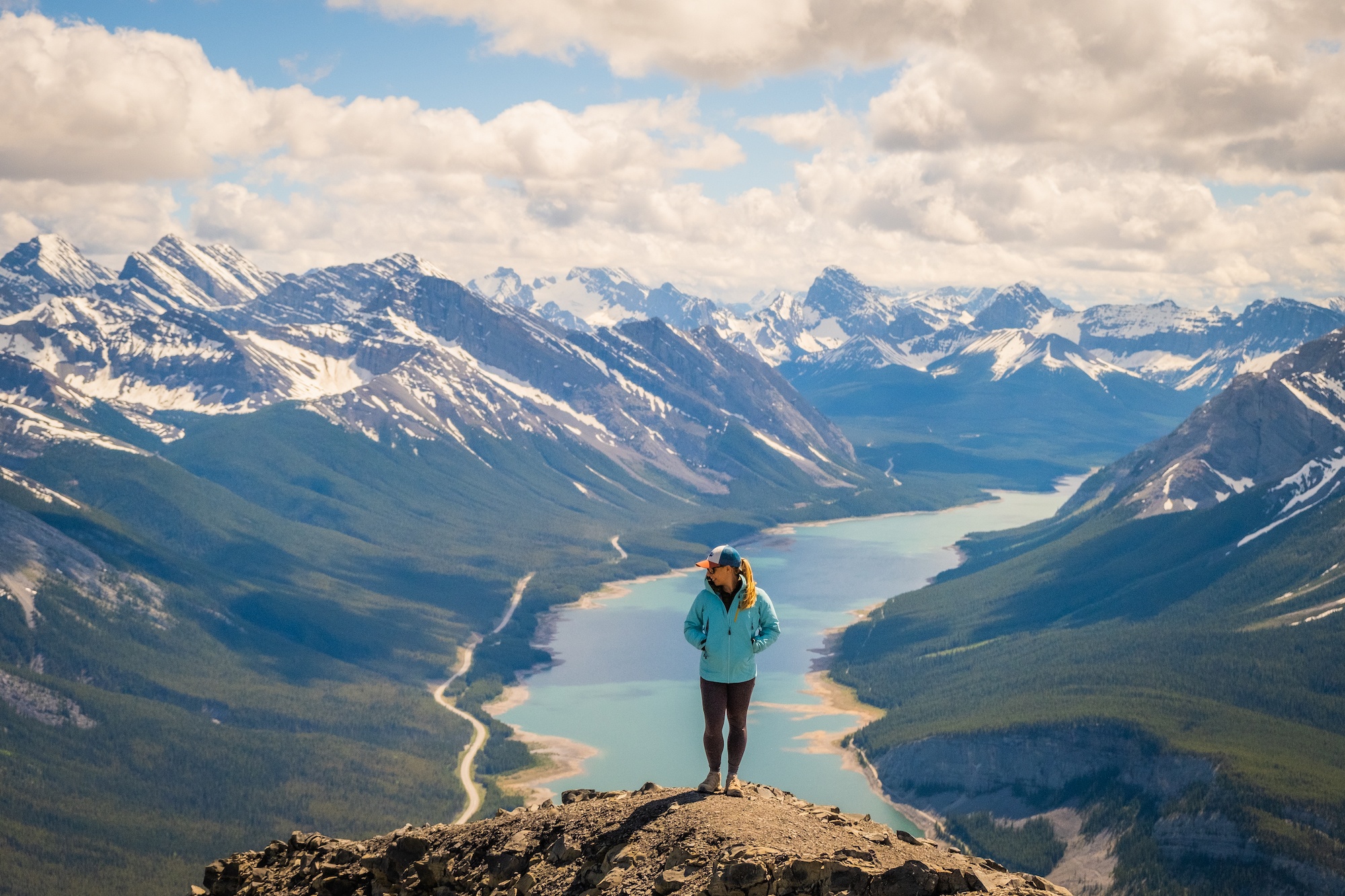
18. Aylmer Lookout
- Length: 24 km
- Duration: 6 – 8 hours
- Elevation Gain: 1,050 meters
- Difficulty: Hard
- Best Time To Go: June – July
- How to Get Here: Roam Transit Route 6
The sheer length of the trail to Aylmer Lookout pushes this hike into the hard category. Unless you’re trail running, expect this excursion to take the better part of a day. Spectacular views reward hikers who make the journey to this panoramic perch that showcases the impressive extent of Lake Minnewanka.
The trail is an excellent option for experienced hikers visiting in June when snow lingers at higher elevations. Between July 10 and September 15, hikers must travel in groups of 4 or more to reduce potential conflicts with grizzly bears feeding in the area.
As an extension of the Minnewanka Lakeside trail, Aylmer Lookout is also accessed by Roam Route #6 in the summer. With almost hourly buses for 12 hours of the day, you should have ample time to complete this rewarding trek.
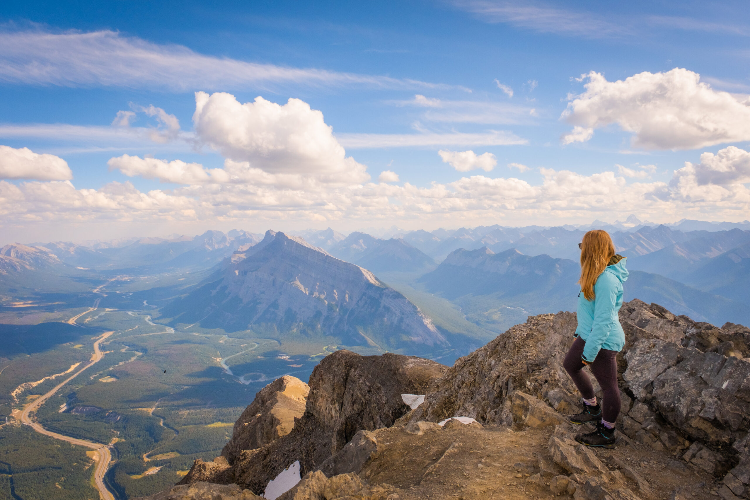
19. Cascade Mountain
- Length: 20.3 km
- Duration: 5 – 9 hours
- Elevation Gain: 1,563 meters
- Difficulty: Hard (easy scrambling)
- Best Time To Go: July – September
- How To Get Here: Norquay Summer Shuttle (free)
Anyone who has visited Banff or seen a postcard will recognize Cascade Mountain. Towering over town, its summit beckons as a lofty hiking objective. A right of passage for many locals, reaching the peak is a notable feat for any hiker. Standing at the top and marveling at the expansive 360 degree views, you could almost forget about the grinding approach.
Even for highly experienced hikers, summiting Cascade Mountain is a long day. Fortunately, Mt. Norquay’s free shuttle operates hourly between 8 a.m. and 7 p.m. in the summer, so you’ll have the whole day to enjoy the trail before catching a return ride to Banff.
Read the Full Guide – Cascade Mountain Hike
20. Cory Pass
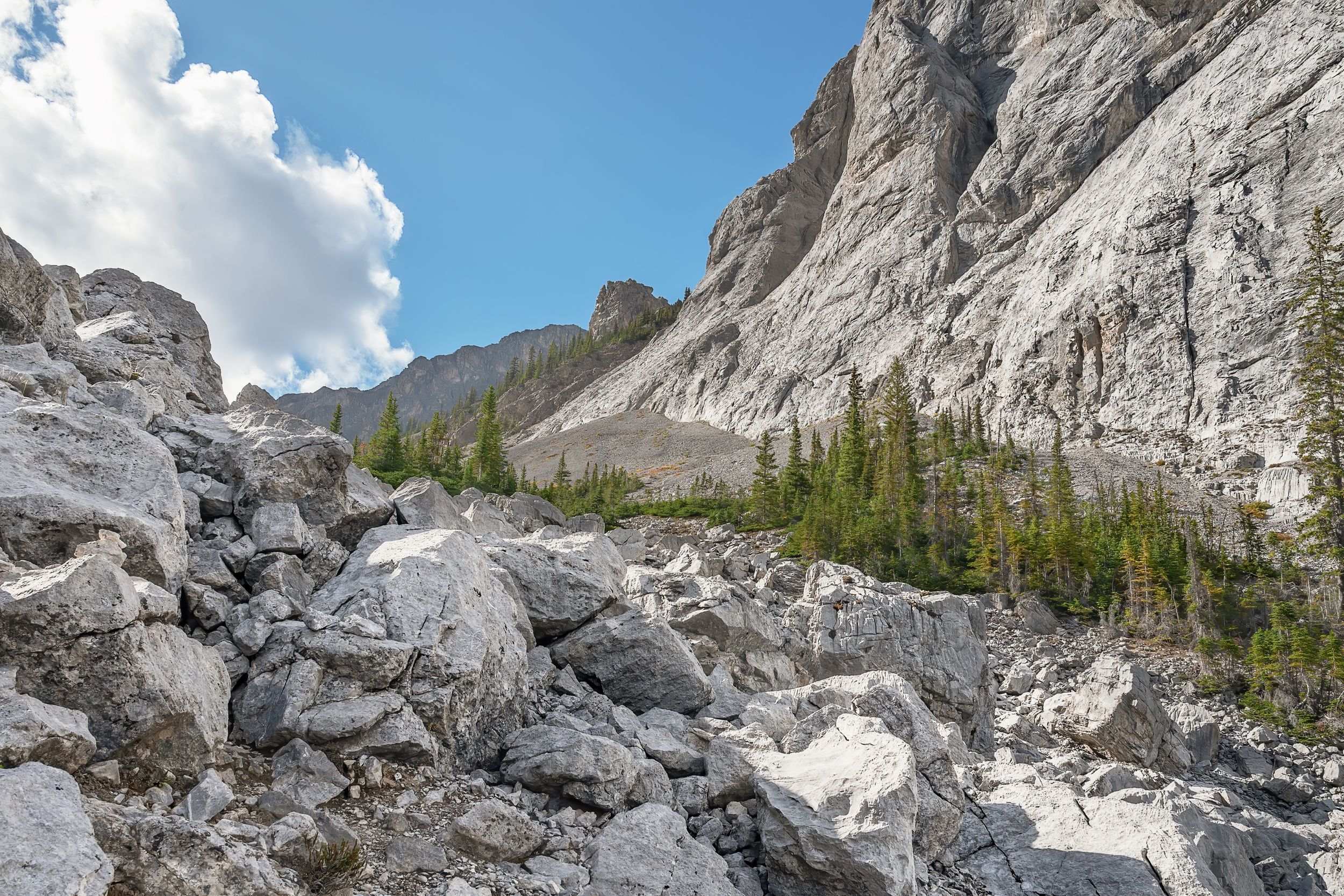
- Length: 13km
- Duration: 4 -7 hrs
- Elevation Gain: 1,168
- Difficulty: Difficult
- Best Time To Go: June – October
- How To Get Here: Bike from Downtown Banff
Cory Pass is a great hike close to town with wonderful alpine views under big cliff faces. It’s one of the more physically demanding hikes on this list, but it’s very rewarding. You’ll need decently strong legs to climb to Cory Pass, as it’s a bit of a grind-up with a quick elevation ascent. Once in the pass, the mountains encompass you, leaving you humbled by the scale.
The best way to access this hike without a car is to bike from Downtown Banff. From Banff Avenue, you’ll bike to Vermilion Lakes along Vermilion Lakes Drive and under the highway. When you see the entrance to the Bow Valley Parkway, hang a right!
21. Mount St. Piran
- Length: 12.2 km
- Duration: 3 – 6 hours
- Elevation Gain: 918 meters
- Difficulty: Hard (easy scramble)
- Best Time To Go: June – October
- How to Get here: Roam Transit Route 8X or Hop on Banff
Hiking to Mount Saint Piran takes you away from the Lake Louise crowds to an incredible viewpoint overlooking the entire valley. In contrast to its trailhead by the luxurious Fairmont Lake Louise, Mount Saint Piran’s peak is rugged and rocky, seemingly removed from civilization. Be prepared for numerous switchbacks to reach the summit, starting with the Lake Agnes Trail and veering off by the Little Beehive to crisscross the scree slopes.
While public buses run to Lake Louise all year, you’ll want to save this hike for the summer months when the snow has cleared and there is no avalanche risk. This is also when Lake Louise showcases its most brilliant blue hues.
Read the Full Guide – How to Hike Up Mount Saint Piran
22. Devil’s Thumb
- Length: 11.9 km
- Duration: 3 – 6 hours
- Elevation Gain: 1,012 meters
- Difficulty: Difficult Hike / Easy Scramble
- Best Time To Go: June – September
- How to Get here: Roam Transit Route 8X or Hop on Banff
This last hike is actually classified as a scramble, requiring hands-on rock at times. Given the complexity and risk, this should only be attempted by seasoned hikers with mountain experience. It’s also recommended to wear a helmet as hikers above may accidentally kick down loose rocks.
Devil’s Thumb’s distinctive summit allows you to marvel over both Lake Agnes and Lake Louise. Along the way, you’ll also be able to check off the Lake Agnes Teahouse and the Big Beehive.
Read the Full Guide – How to Hike Devil’s Thumb
Car-Free Travel Tips
- Familiarize yourself with the bus system ahead of time. Traveling Banff without a car relies heavily on Roam Transit, the bus system that serves the Bow Valley. Knowing the stop locations, schedules, and how to pay will help ensure smooth, stress-free travel. Some bus routes are seasonal and may not run outside of the summer months.
- Reserve tickets in advance where possible. Banff receives over 4 million visitors a year, with many traveling during the summer months, leading to strong competition for shuttle and bus bookings.
- Give yourself ample time to make the return bus trip to Banff. While Banff has an exceptional transit service for a mountain town, buses only run for limited hours of the day and some stops do not have cellular service. While hiking, set a turn around time that ensures you can catch the last bus.
- Base yourself in the Town of Banff to make traveling without a car easier. You can walk to many sites in town and easily connect to buses that depart from the town center. Lake Louise is more remote, and while the Town of Canmore is walkable with its own attractions, it’s an extra bus ride away from Banff’s most popular sites.
- National park passes are required for all visitors to Banff regardless of transportation type.
Hiking Advice for the Canadian Rockies
- If it’s your first time hiking in the mountains, take a conservative approach – read our post for beginner hikers in the Canadian Rockies too. Pick an adequate hike for your fitness, plan for plenty of time, pack water and food, and don’t be afraid to turn around. If you want to learn more about what to wear hiking, we have a great post.
- Check the weather and conditions before leaving home. Trails may be closed on occasion due to wildlife or poor conditions. AllTrails is a great resource with reviews from those who recently completed the trail.
- Plan ahead in case of emergency and consider that many trails further away from Banff, Lake Louise, and Canmore lack cellular service.
- Be aware of wildlife and always carry bear spray. You can also stay safe in bear country by respecting advisories, maintaining an awareness of your surroundings, making noise on the trail, hiking in groups, and packing out all food and waste.
Plan Your Trip to the Canadian Rockies
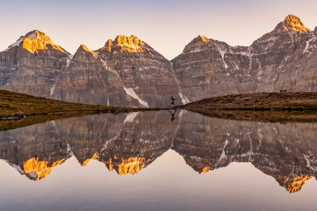
- Recommended Experiences: There are so many things to do in the Rockies, but our top recommended experiences include the Banff Gondola, taking a cruise on Lake Minnewanka, and enjoying a cruise on Maligne Lake out to Spirit Island in Jasper. If you are looking for a stress free way to get to Moraine Lake, we highly recommend looking into Moraine Lake Bus Company.
- Hotels in the Rockies: There are many places to stay, from luxury hotels to wilderness cabins. See all our favorites here.
- Get to Banff or Canmore Without a Car: The Banff Airporter provides fantastic service connecting you from the Calgary International Airport (YYC) to Banff or Canmore.
- Get Around: We suggest renting a car to get around. You can search for rental cars on Rentalcars.com. Or embark on an epic campervan trip, we like to compare camper prices on Outdoorsy.
- Cheaper Airfare: We also use Going to watch for cheap airfare deals and like to use travel credit cards to hack our way into free flights and hotels! Our favorite cards are the Capital One Venture X and Chase Sapphire, which both work well in Canada and have no foreign transaction fees.
- Hop On, Hop Off: This tour is taking Banff by storm. It’s exactly what it sounds like, hop on and off a bus bound for all the best attractions at your own pace!